2016 Team Rim-to-Rim-to-Rim Run
Posted 26 May 2016 in News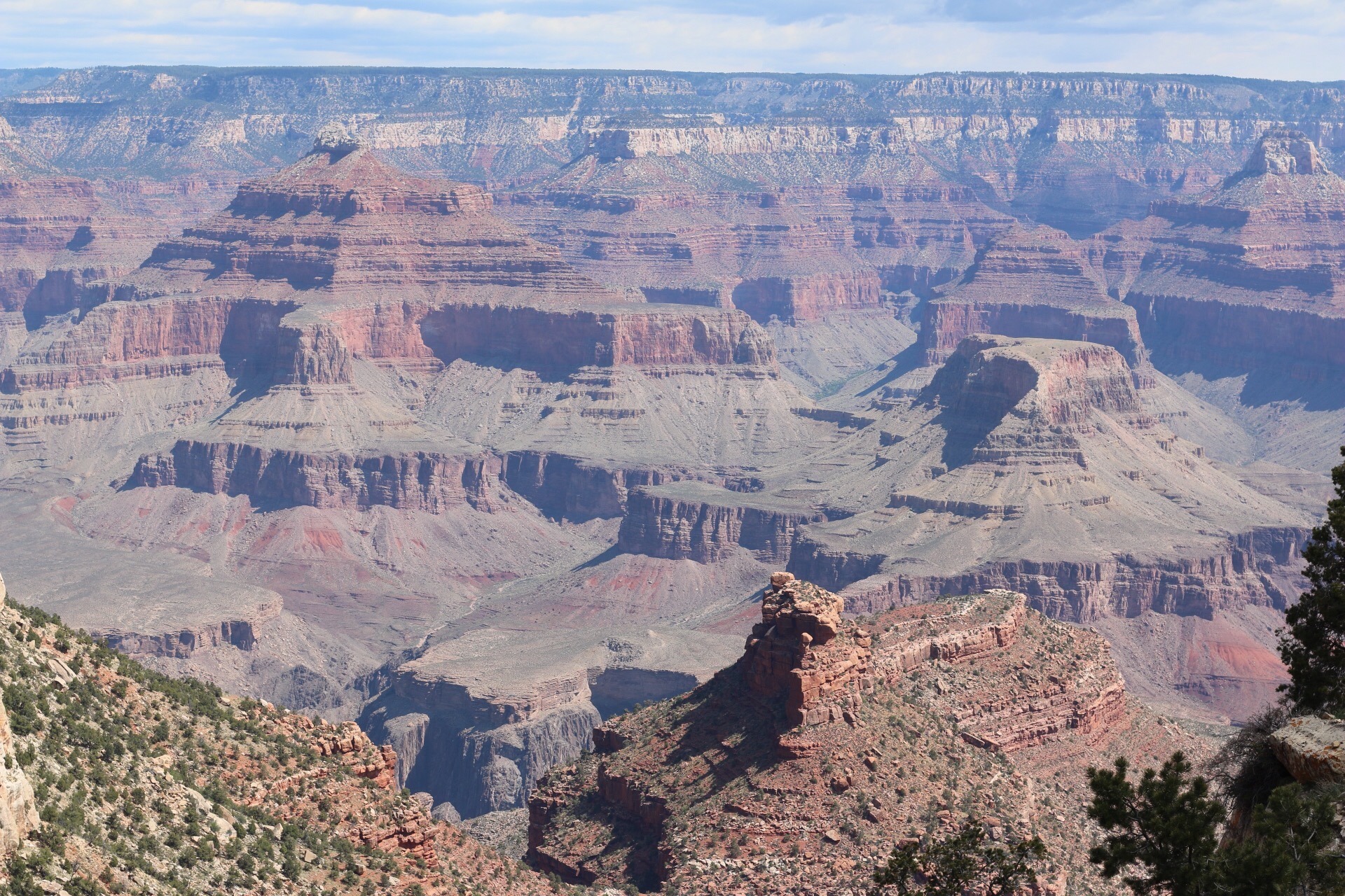
2016 Team Rim-to-Rim-to-Rim Run by Eric Haselby
WARNING – I could have written a brief post about the basic logistics of the run, but I felt the adventure deserved something more. The goal of this “novel” is to give me something to look back on, and to help those who may be looking to complete the adventure in the future. Grab a Snickers…
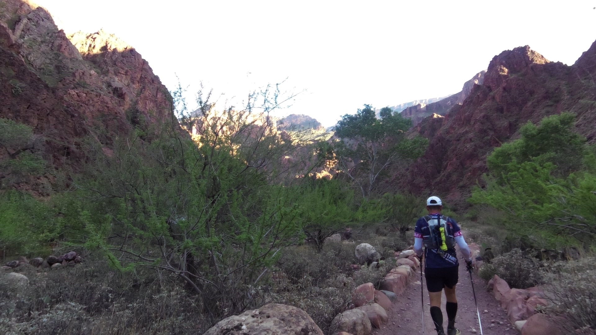
It’s dark. The only light I see is being projected from my forehead, which robs you of your depth perception. It feels like I am on a never-ending stair stepper; just as I step over the log/rock, another appears. My mouth is uncomfortably dry, and I can feel the grit in my teeth from the hours of blowing dust. Although I am glad I am hydrated enough to sweat, I’m not very happy about the sweat continually running into my eyes, which combined with the dust, makes for an unhappy eyeball. Three feet to my left, a sheer rock face. Three feet to my right, an abyss of pure darkness. I’m moving slower than I could ever imagine, but I am continually gasping for air. My legs ache, my heart rate wont come down, and there seems to be no end to this climb. What went wrong? How did I get myself here? Suddenly the Grand Canyon wasn’t feeling so “grand.”
About six months earlier, Brian (www.briansrunningadventures.com) and I were talking about bucket list items during a run, and Rim-To-Rim-To-Rim came up. Also known as R2R2R, or R3, this is the crossing of the Grand Canyon from one rim to the other, and back, in a single day. At the time, I didn’t hesitate, and told him to count me in. Little did I know, R2R2R covers almost 50 miles of trail, and over 20,000 feet of elevation change. As soon as I started doing research and planning logistics, I knew it was going to be an epic challenge!
I had a few marathons and one ultra scheduled before the R2R2R, so I felt comfortable knowing I had a solid training base. I peppered in some hill repeats (as much hills as you can find in the Hampton Roads area of Virginia), and spent some time on a treadmill that goes up to a 30-degree incline. I ran with a full pack a few times to make sure there were no issues, but other than that, I did no specialized training.
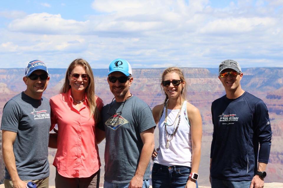
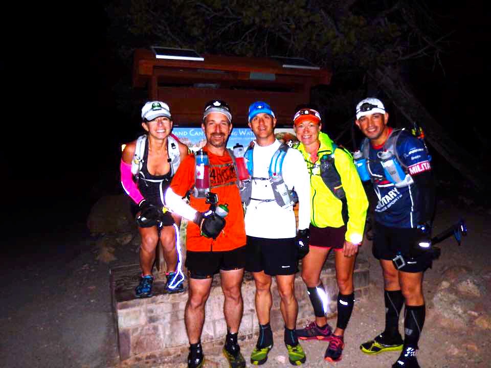
I am the Running Team Manager for the US Military Endurance Sports Team (www.USMES.org), so I invited some teammates to join Brian and I on our adventure. I ended up recruiting Jamie, Joshua… aka “Dewey” (www.deweyspath.com), and Lori (www.thecadencekitchen.com). We worked for months planning the flights, rental car, and other logistics. Before we knew it, it was time to head to the canyon.
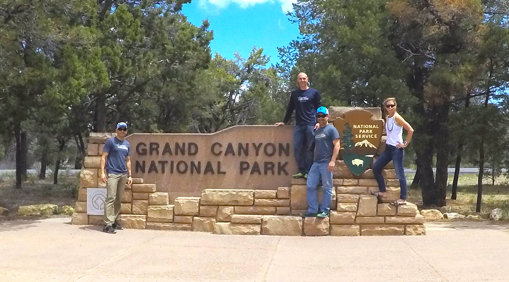
We all flew into Phoenix around the same time (all coming from the east coast) so we could all share one vehicle. We loaded up our rental van and headed to our cabin in Flagstaff (booked via VRBO). We opted to stay near Flagstaff because of the restaurants, shopping, etc. Plus, it was better to have an actual house with a kitchen so we could cook instead of being required to eat out each meal. The plan was to arrive two days before the run, and leave the day after the run. This allowed for an alternate run day, just in case the weather decided not to cooperate. This also allowed a small amount of elevation acclimation time, even though we were well short of the seven days usually required to fully acclimate. By the time we got to Flagstaff, did our shopping, and got settled into the cabin, we were exhausted, so we all turned in early.
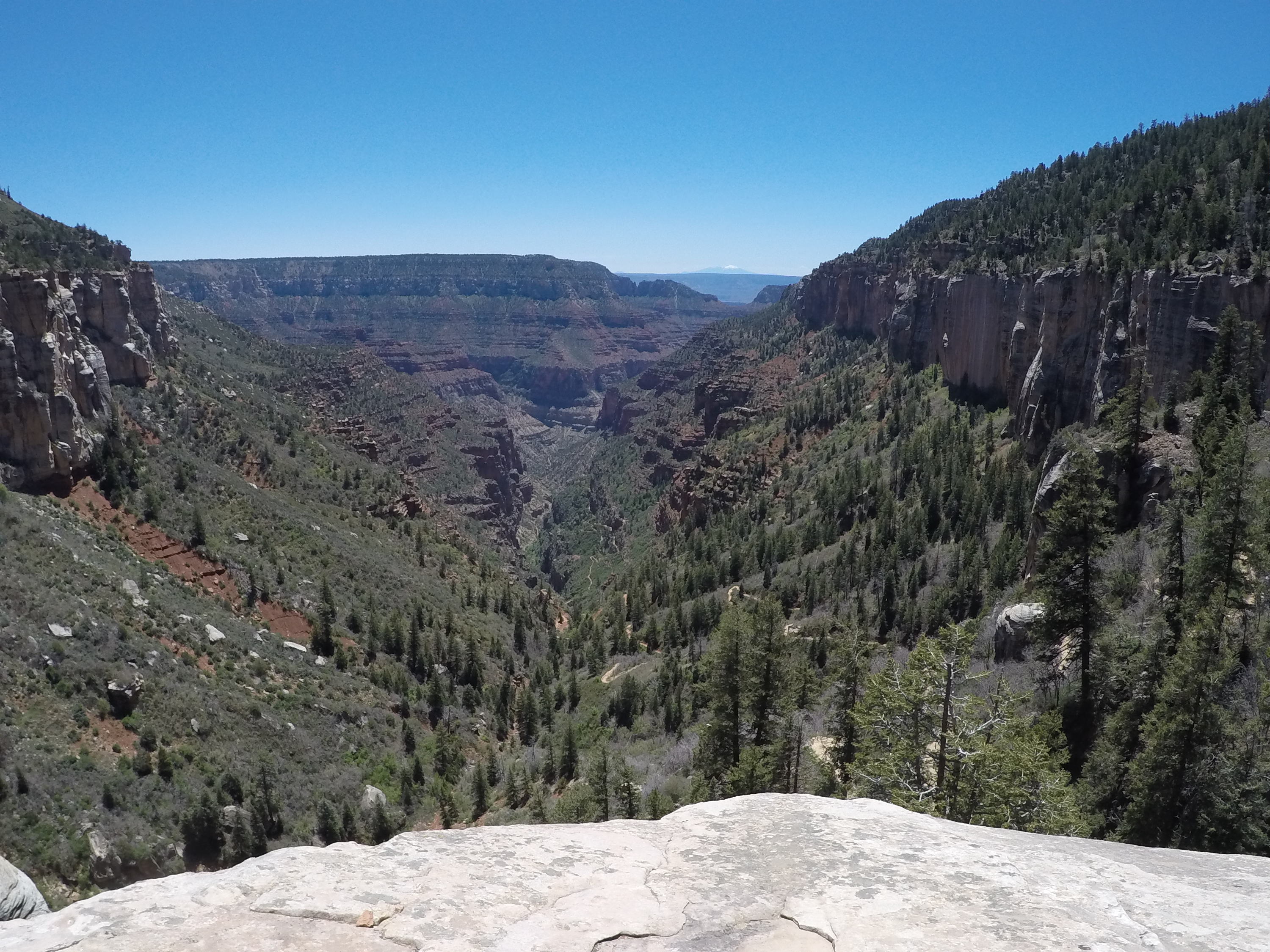
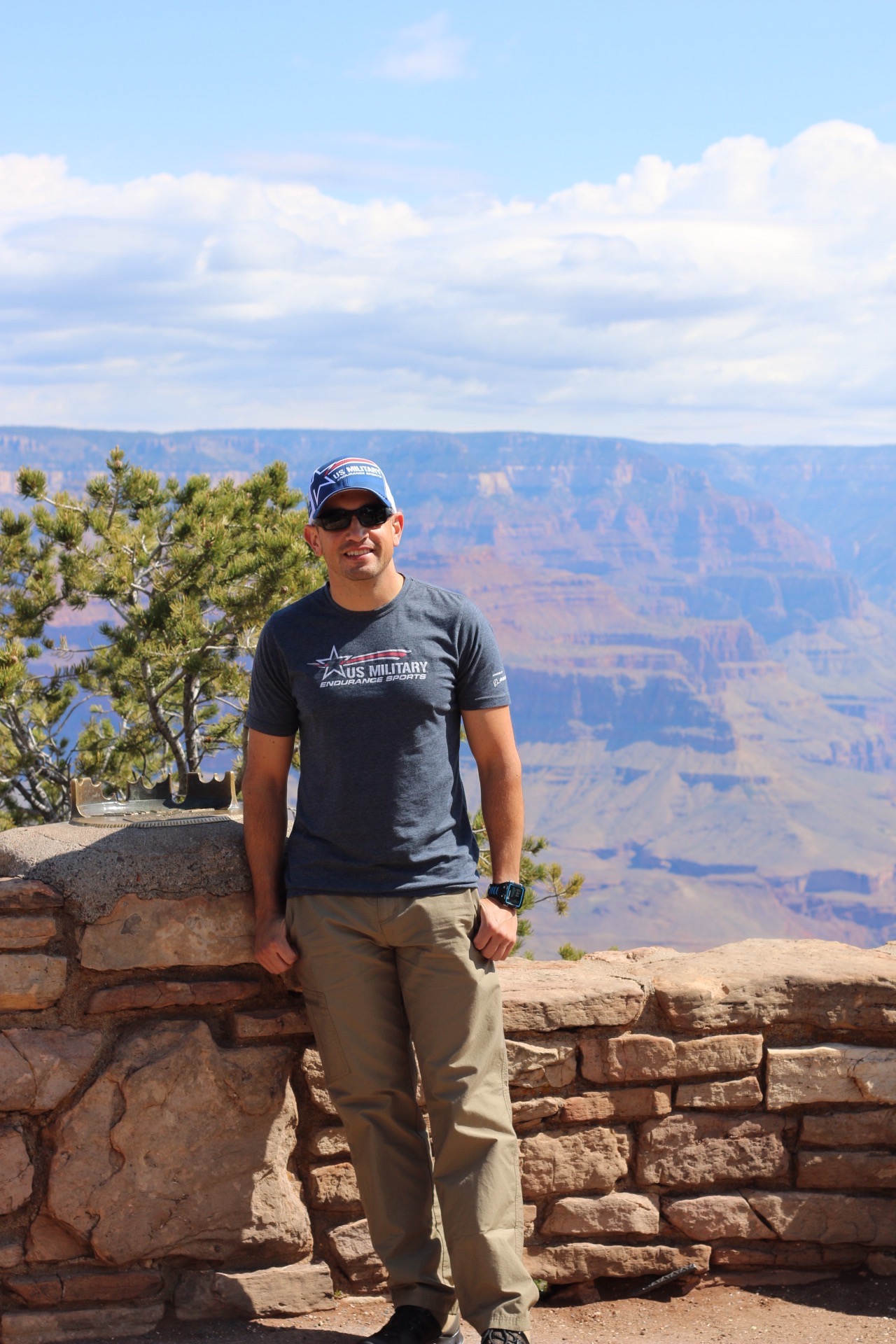
It was 24 hours until our run, and we used the time to do the tourist thing, scope out the canyon, find out where we were going to park, meet up with our last runner (Jamie), and finalize the last of the things on our to-do lists. However, it had been a couple of years since my last time at the canyon, and I probably would have slept better if we didn’t go take a look prior to the run. I still have yet to find a single photograph that can do the canyon justice. The last time I was there, it was beautiful; this time it was horrifying. The vastness and magnitude made me want to throw up in my mouth and pee my pants… at the same time. “What do you mean you can’t see the North Rim from here? Sure I can… it’s right there! That’s not the North Rim? Shit.” We pulled our jaws off the ground and headed back to Flagstaff. We spent the rest of the day eating, cooking, eating, packing, eating, shopping, and eating. I think we even did a little hydrating somewhere in there.
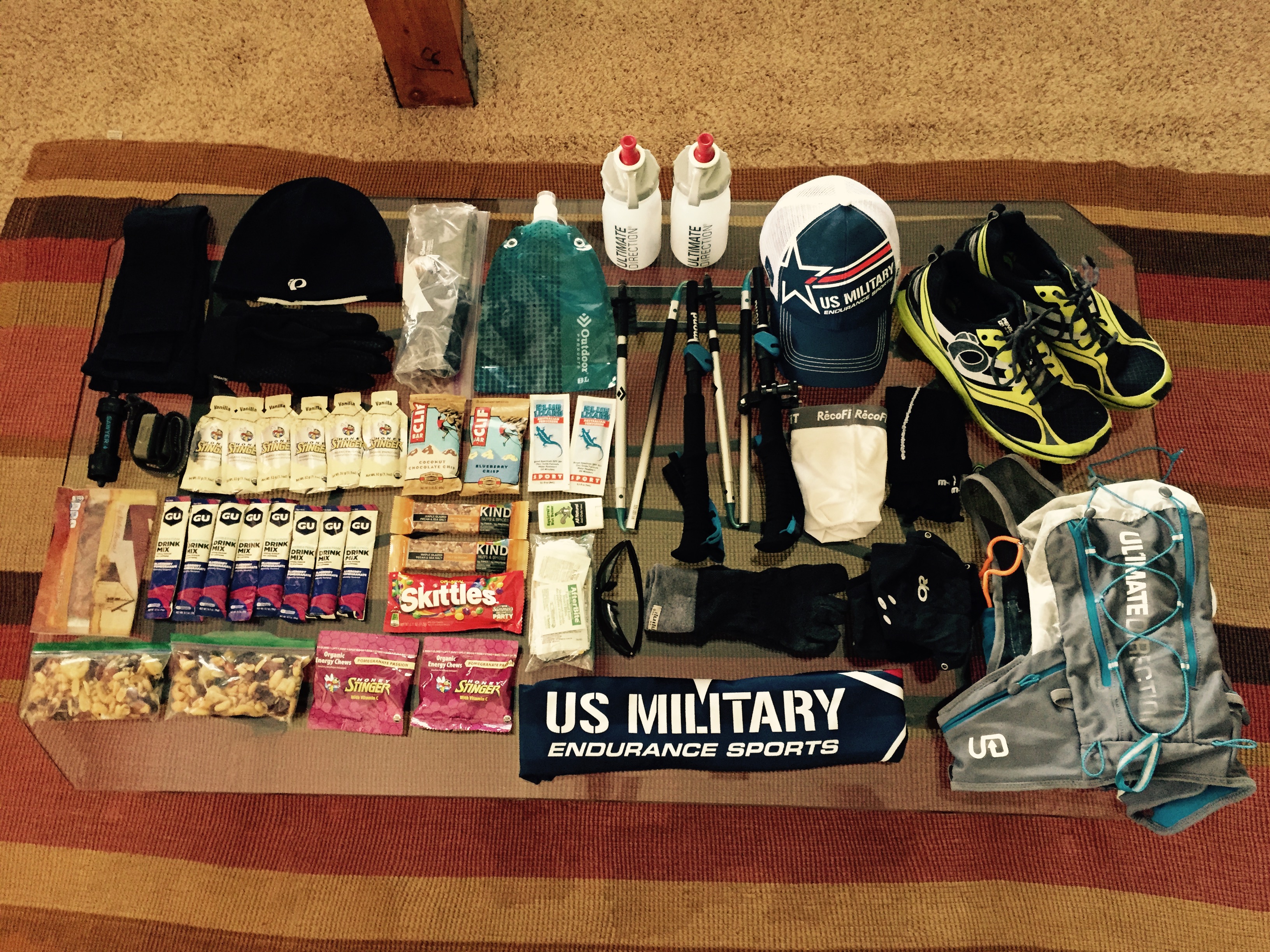
If you are interested in seeing exactly what I packed/carried, check out my post at http://www.runridelife.com/?p=242.
I have never been so happy to be on east coast time, falling asleep around 8pm and getting up at 1:30am wasn’t near as difficult as I though it would be. Why 1:30am? Well, other bad part about staying near Flagstaff is the hour and a half drive through the most dense population of elk and deer I have ever seen in my life (and I grew up in the mountains). If you decide to go that route, be sure to have a second set of eyes helping you spot the potential 800-pound hood-ornaments. With a plan to start running by 4:30am, we had to leave the cabin by 2:30am. This gave us enough time to park the car where we planned to finish, and catch a ride to the point we planned to start from.
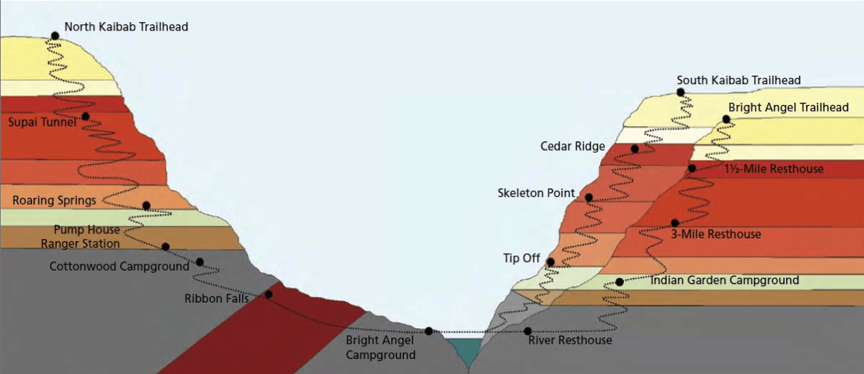
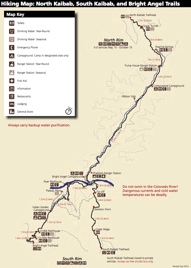
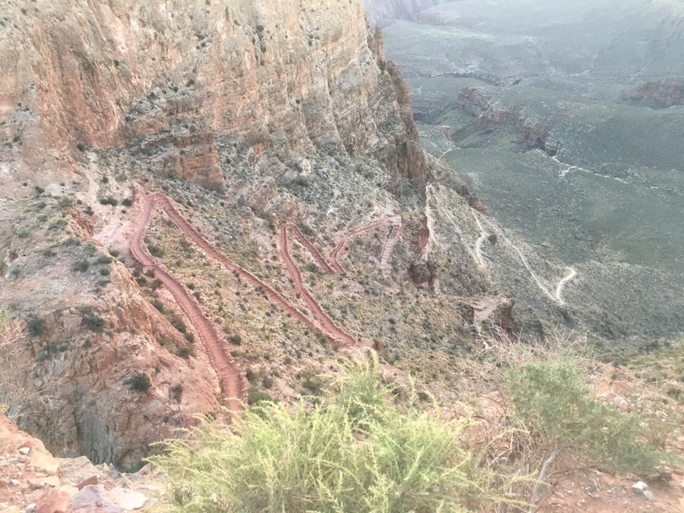
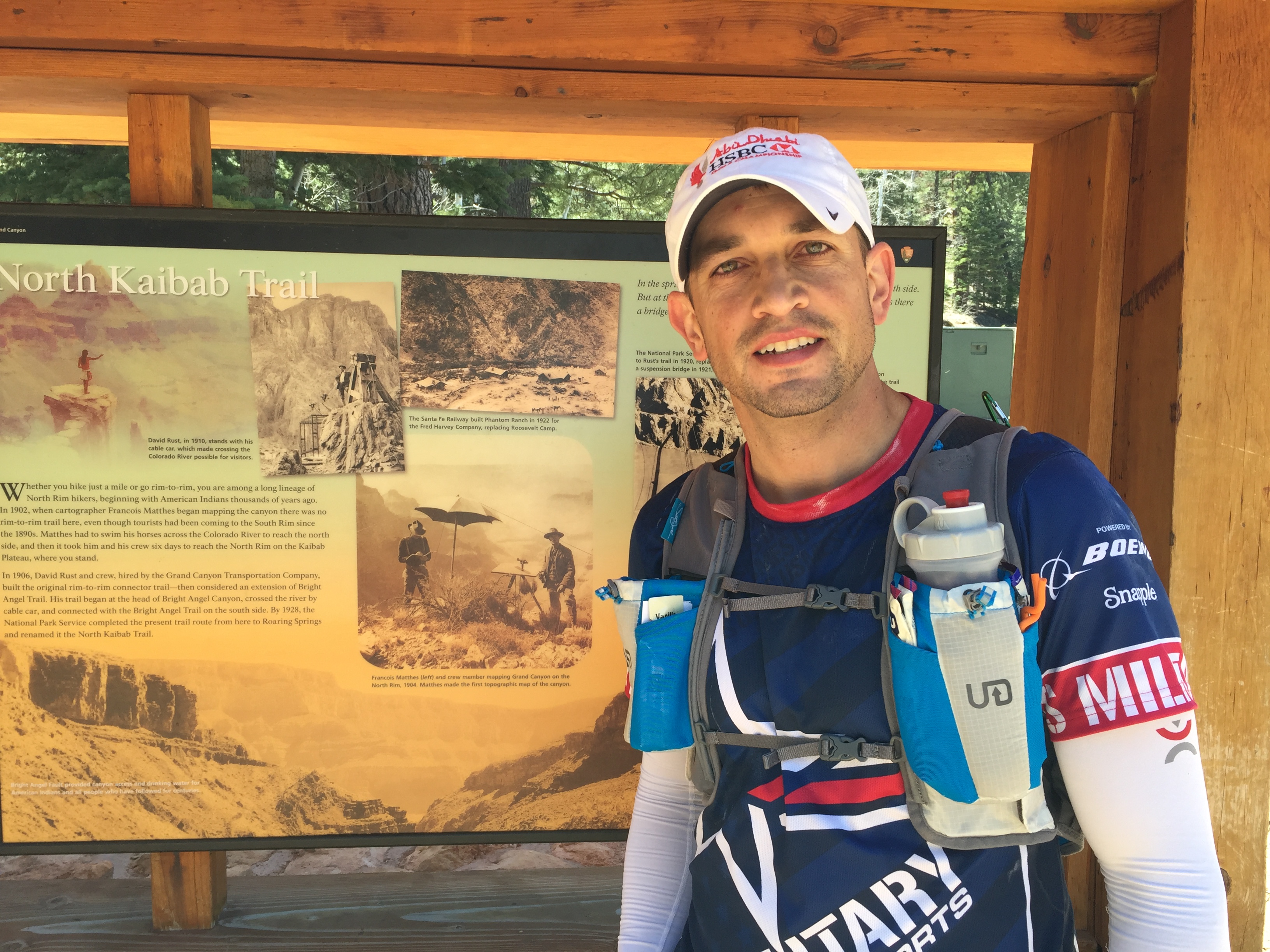
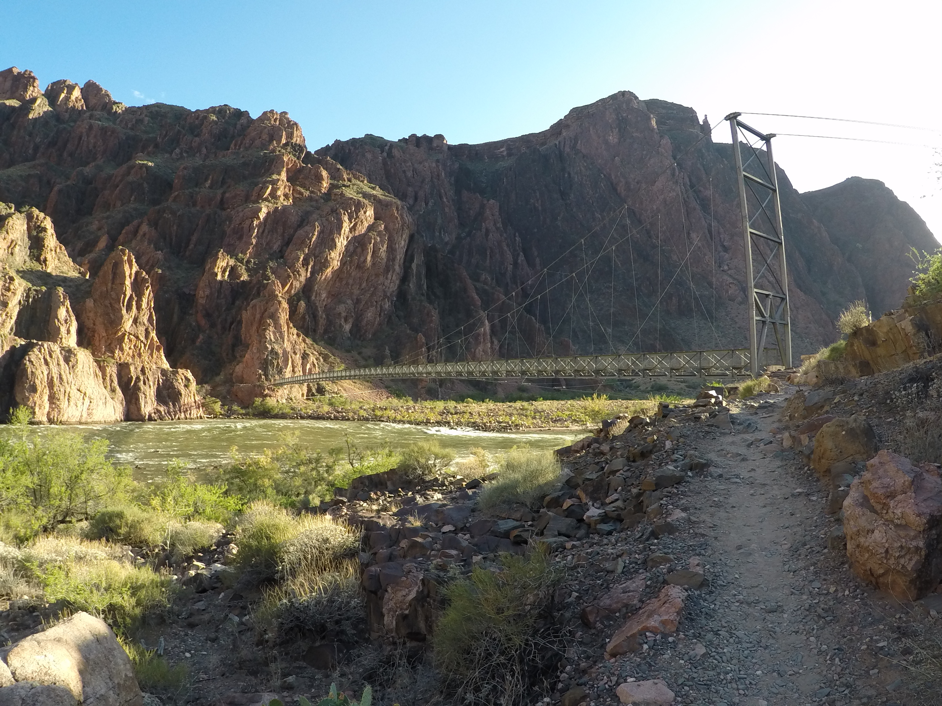
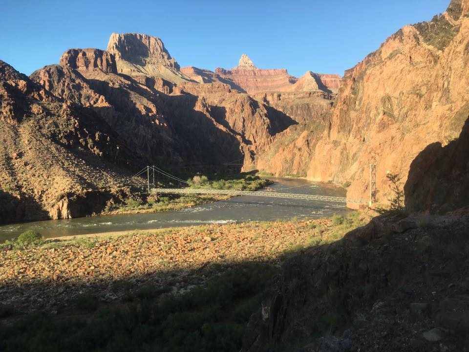
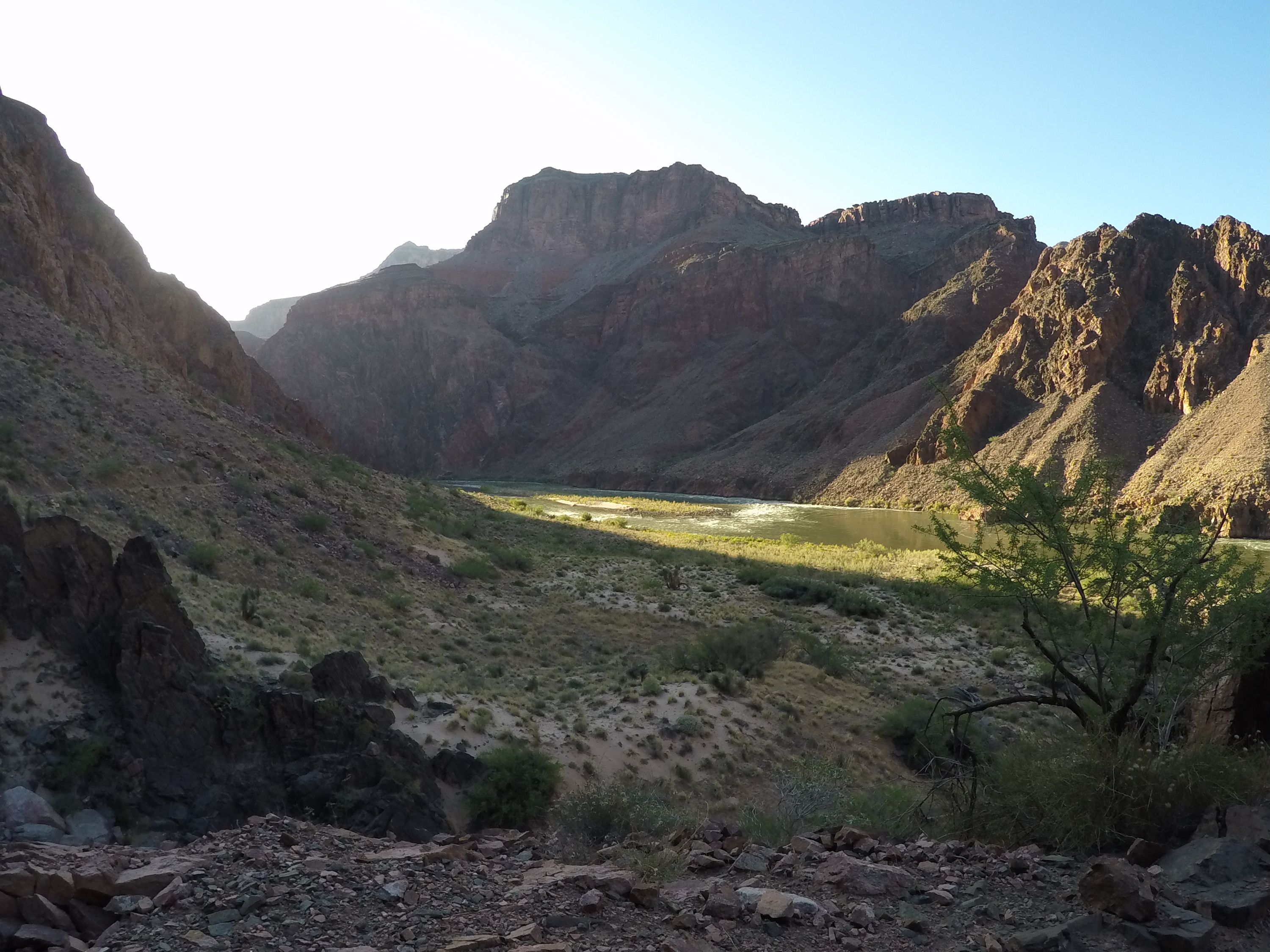
R2R2R has a few trail options. From the South Rim, you have the choice of either South Kaibab Trail (SKT), or Bright Angel Trail (BAT). Most runners, including our group, choose to descend SKT and come up BAT. SKT is shorter, steeper, and has NO water. BAT is longer, not as steep, and has plenty of water. To me, it is a no brainer, but I was quite surprised how many blogs I read about people ascending the SKT. On the North Rim, you don’t have as many choices; you can go up the North Kaibab Trail, or don’t go at all (I probably should have chosen the latter). All three trails come together (or fairly close) at the Colorado River near the Bright Angel Campground and Phantom Ranch.
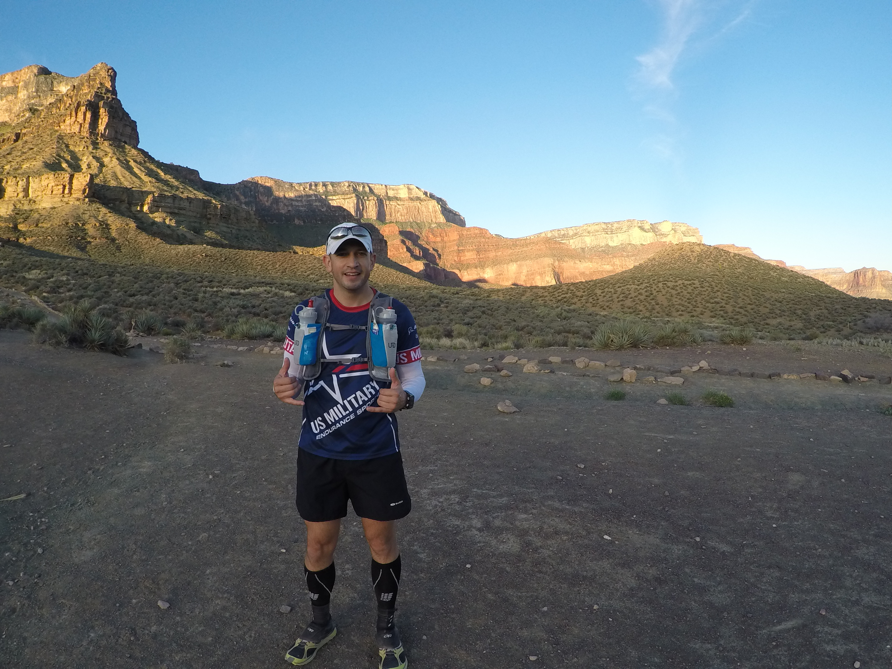
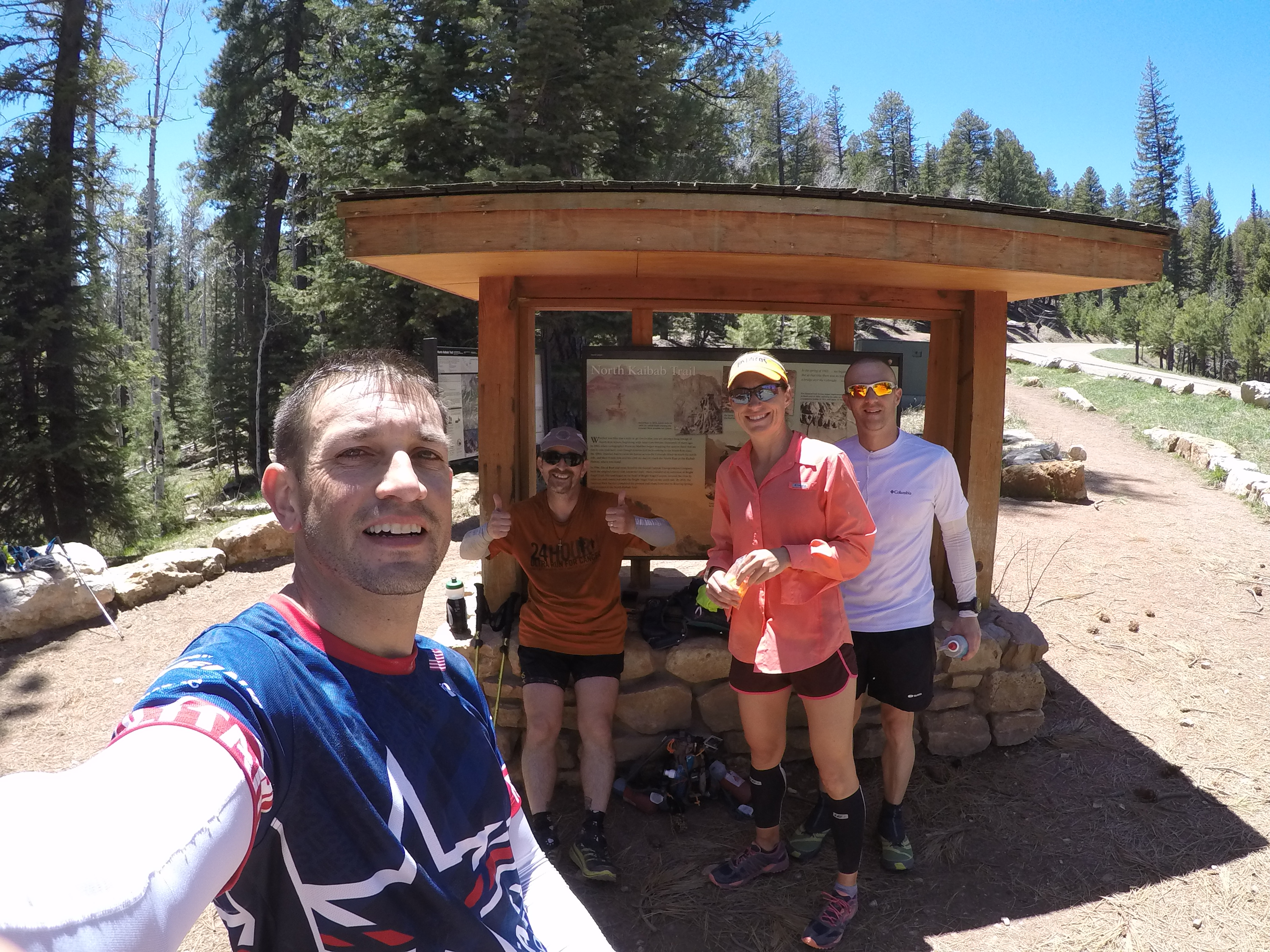
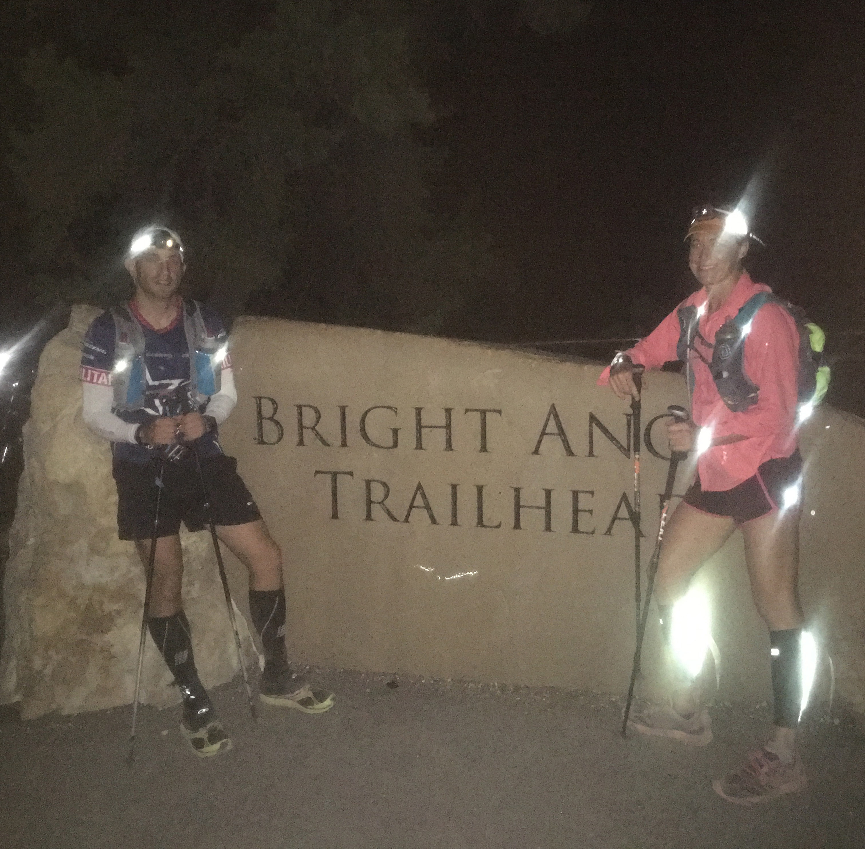
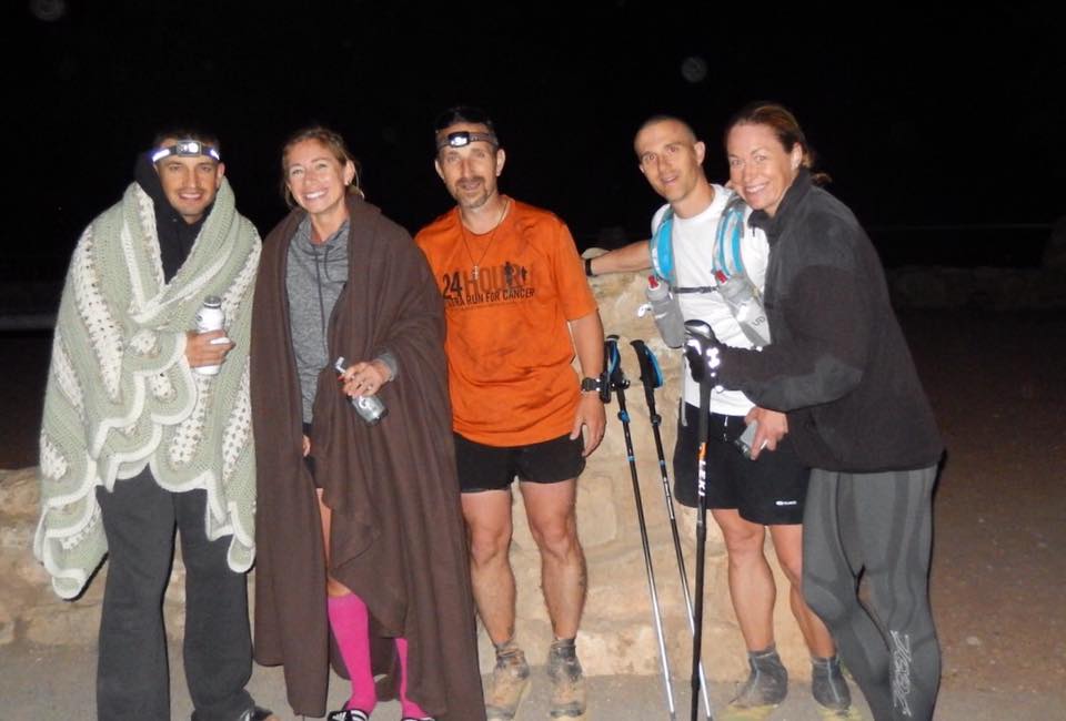
We made it to the Bright Angel Trailhead where we met up with our other runner and volunteer driver (thanks, JD!). We used our rental shuttle to get everyone to the South Kaibab Trail, then JD took our car back to the Bright Angel Trailhead so we would have it when we finished… or IF we finished. Some last minute preps, a couple photos, and it was time to get moving. (7,260 feet, 4:42am).
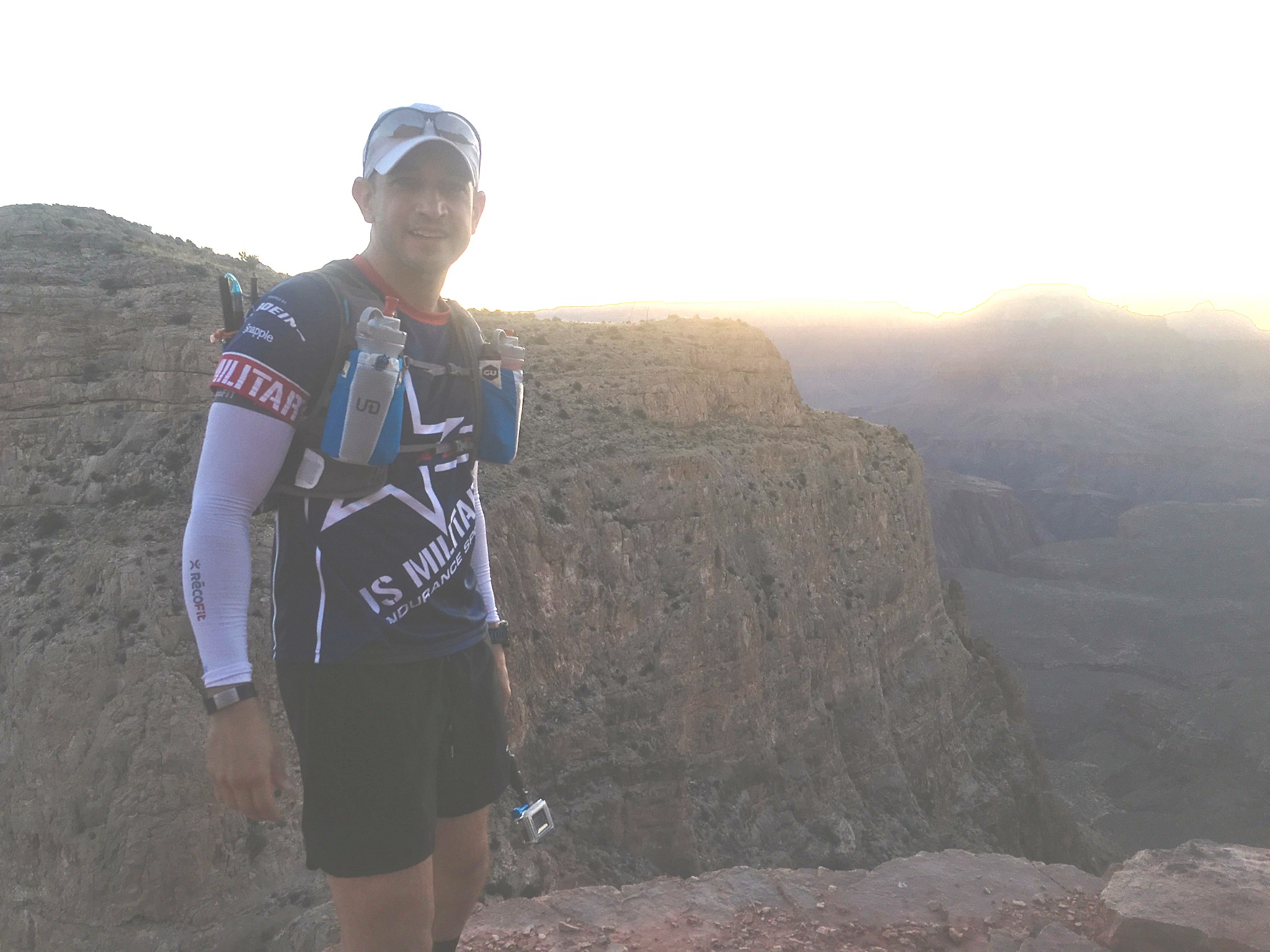
As anticipated, it was cool and dark. I opted to throw on my arm warmers, gloves, and headlamp before we left. Of the three items, I quickly realized only one was really necessary. It couldn’t have been 10-12 minutes before I had worked up a sweat, and now I had the pleasure of carrying my gloves and arm warmers for the rest of the day. Usually I wouldn’t mind it, but the forecast showed a very hot day (even on the North Rim), with zero chance of any moisture. Not the smartest move of the day, but I knew it was the first of many since I had plenty of time to add things to the dumb decision list. And to answer your question, “running R2R2R” wasn’t on my dumb decision list… yet.
So why start so early? Initially, it was to beat the mule train. South Kaibab Trail is also a superhighway for the mules that deliver goods and packs from the South Rim to the different camps within the canyon. Since the trail is mostly single-track, there are only certain areas you can pass the string of 8-10 mules. Until you reach those areas, you get to slowly follow them and take in their sweet aroma. The second reason for starting so early is to capitalize on the daylight. In early May, there is 15 hours of visible light, with 14 hours between sunrise and sunset. I had a goal of finishing in 15 hours, and climbing Bright Angel Trail with the sun still up would be an amazing site. I had planned to take tons of photos and video along the way, and I didn’t want my video to end like so many others out there… halfway up the canyon.
The team was moving great; not too fast, not too slow. However, I did notice that my heart rate was really high. We were running at a conversational pace, but my heart rate hovered in the 168 range, which is WAY too high. I would take occasional walking breaks to bring it down into the 130’s where I wanted it. The footing can be pretty tricky as you bound from log step to log step, avoiding loose rocks, while still trying to look up from time to time to watch the sun break over the North Rim. Even after only a few minutes, I could start to feel fatigue in my quadriceps, and we had a LONG way to go. How far? Here are the numbers:
From the South Kaibab Trailhead (7,260 feet) to the Bright Angel Campground (2,480 feet) is 7 miles, and you descend 4,780 feet.
From the Bright Angel Campground (2,480 feet) to the North Kaibab Trailhead (8,241 feet) is 14 miles, and you climb 5,761 feet.
At the North Rim, you turn around and the North Kaibab Trailhead (8,241 feet) to the Bright Angel Campground (2,480 feet) which is the same 14 miles of trail, but you descend the 5,761 feet you just climbed.
Back at the Bright Angel Campground (2,480 feet), you head to the Bright Angel Trailhead (6,860 feet), which is a 4,380 foot climb covering 9.5 miles.
If you stick to the trail, you will cover about 45 miles, climb 10,141 feet, and descend 10,541 feet. (Typing this makes my legs hurt)
It was probably 20 minutes into the run when we began to notice fresh mule poo. I found it strange since we obviously left the trailhead before their advertised 5am departure. They must have gotten an early start, because there they were, in all their smelly glory. We followed closely, but not too closely behind until we were given permission to pass. If you encounter the mule train, please be courteous and listen to the train drivers. They will let you know when it is “safe” to go around. I say “safe” because there isn’t much guaranteed safety within the canyon walls.
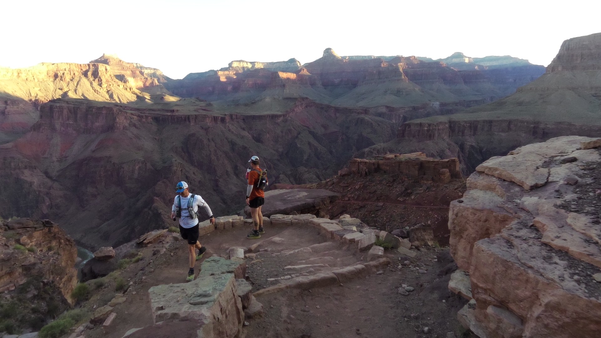
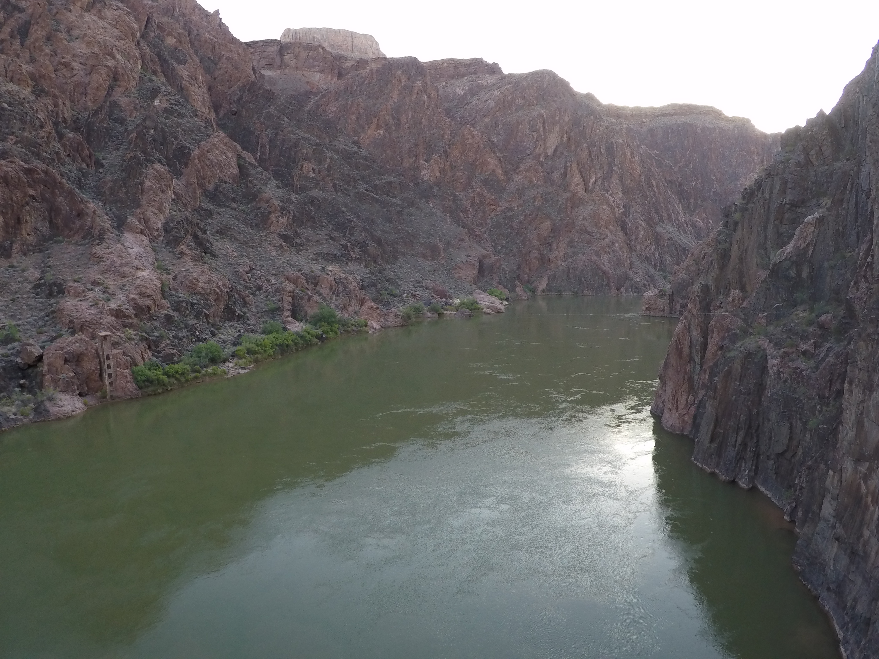
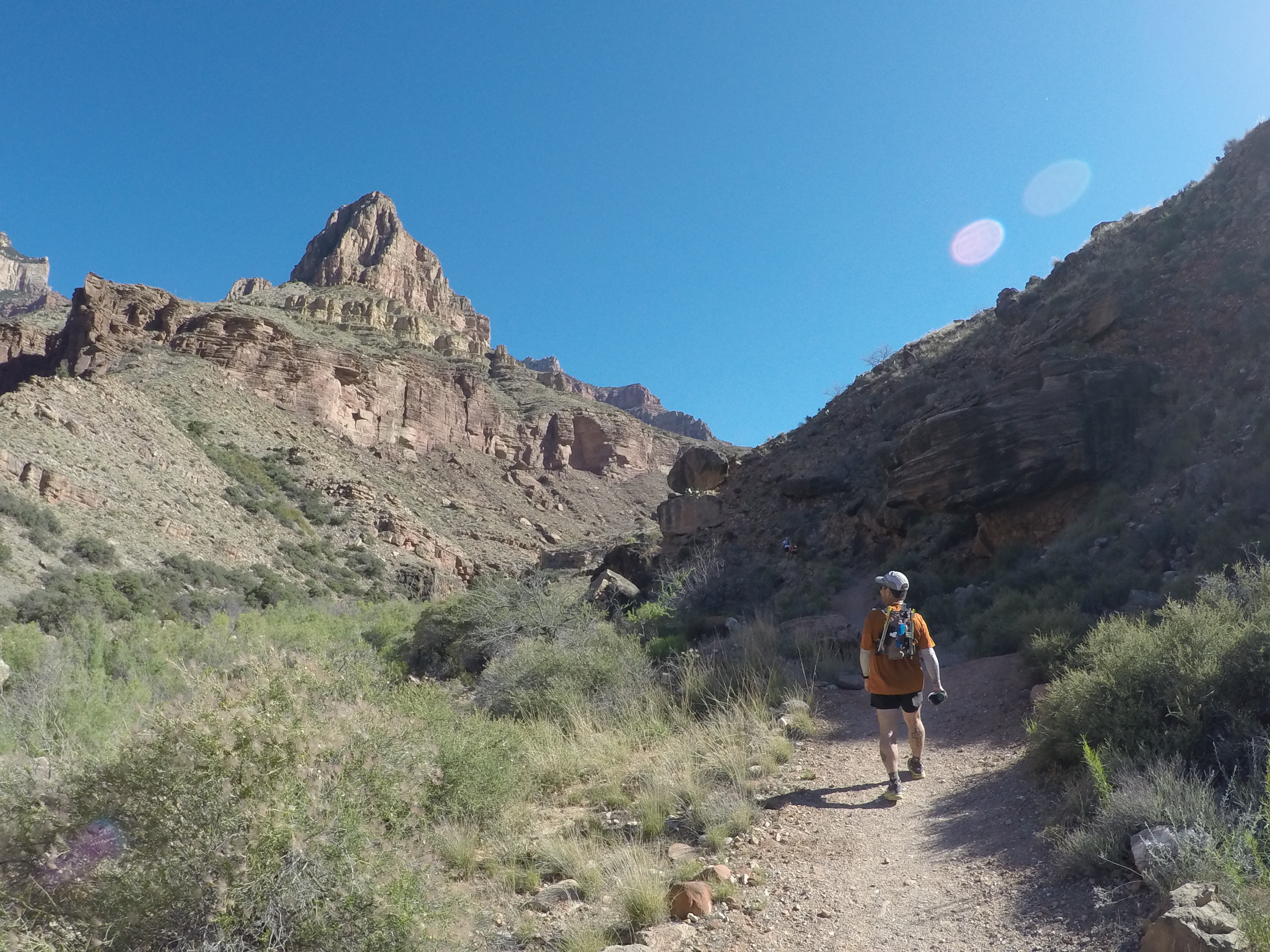
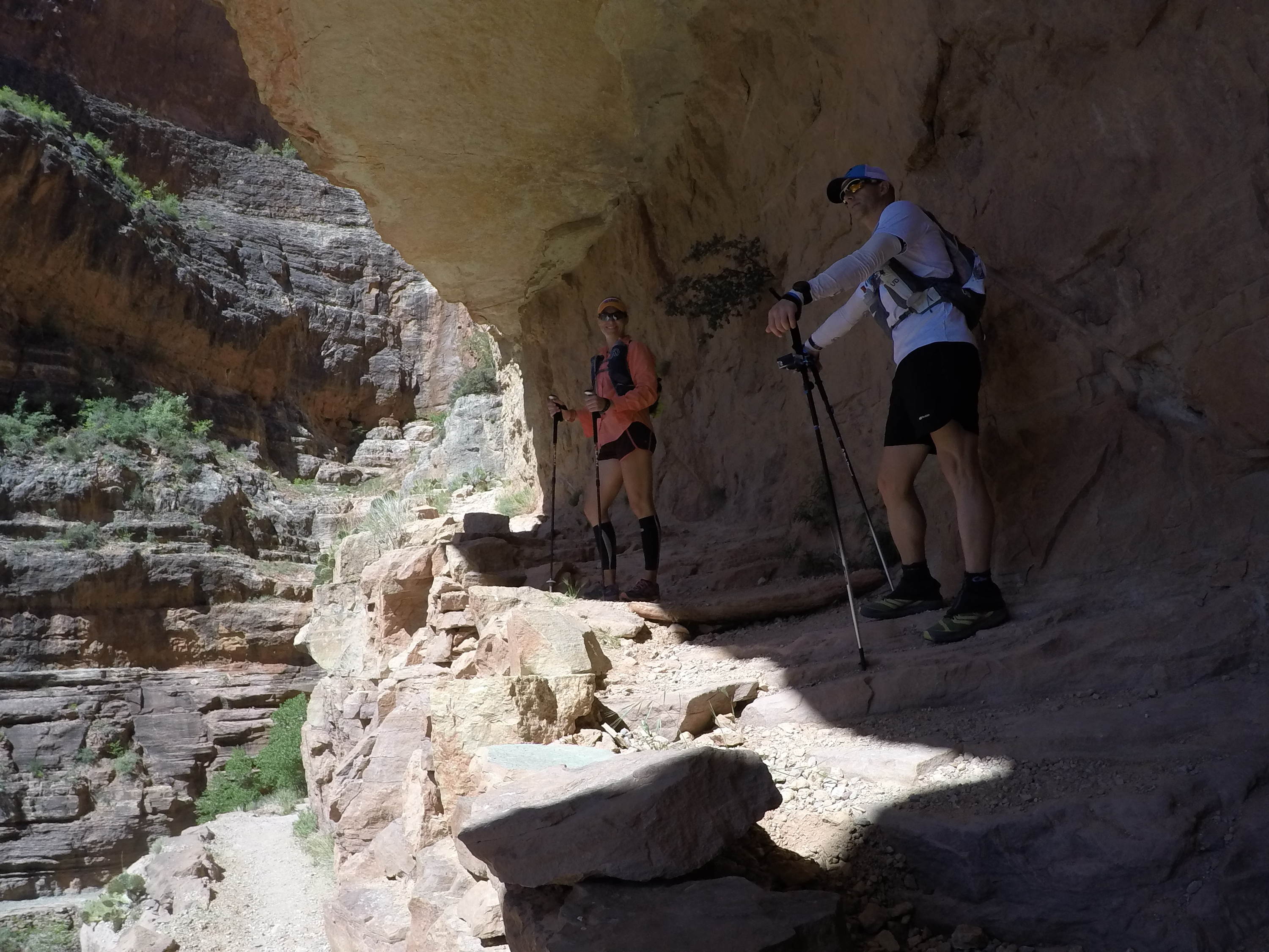
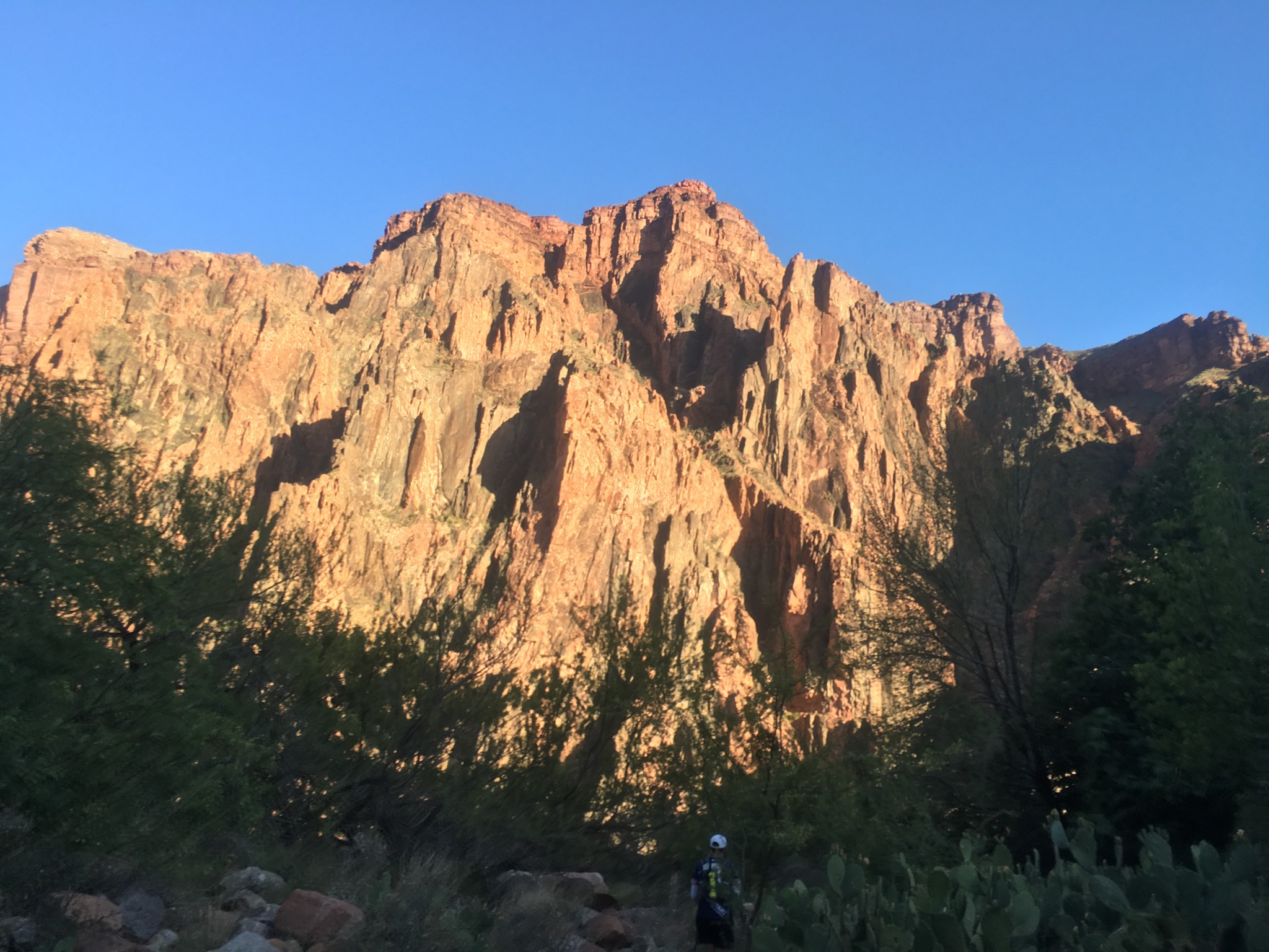
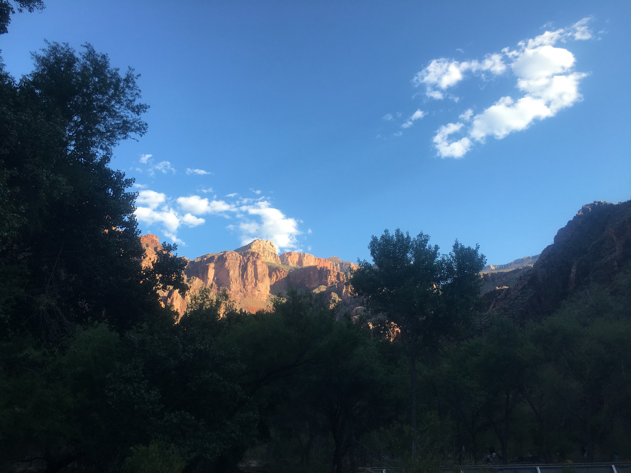
We continued our descent, doing our best to save our legs (yeah right). It was finally bright enough to start taking video, snap photos, and enjoy the unbelievable scenery that no other place on earth can offer. It really is breathtaking… literally… but that could be because I live at 30 feet above sea level in Virginia. We were smiling, joking, and laughing, but we all knew that wouldn’t last throughout the day. I noticed my heart rate was still very high, but I pressed on. We made two quick stops at Cedar Ridge (6,120 feet) and Skeleton Point (5,200 feet) on the way to the river to adjust our packs, put away our useless cool weather gear, and use the environmentally friendly restrooms. I probably took three times more photos in the first 7 miles than I did the rest of the day (funny how that happens). As we neared to the bottom of the canyon, the temperature began to rise. “Crap. It’s only 6am and I am already sweating. It’s going to be a long, hot day!” We were making good time, sprits were high, but we all took a pretty good beating to our legs on the way down. Before we knew it, we had reached the Colorado River (2,480 feet, 6:30am).
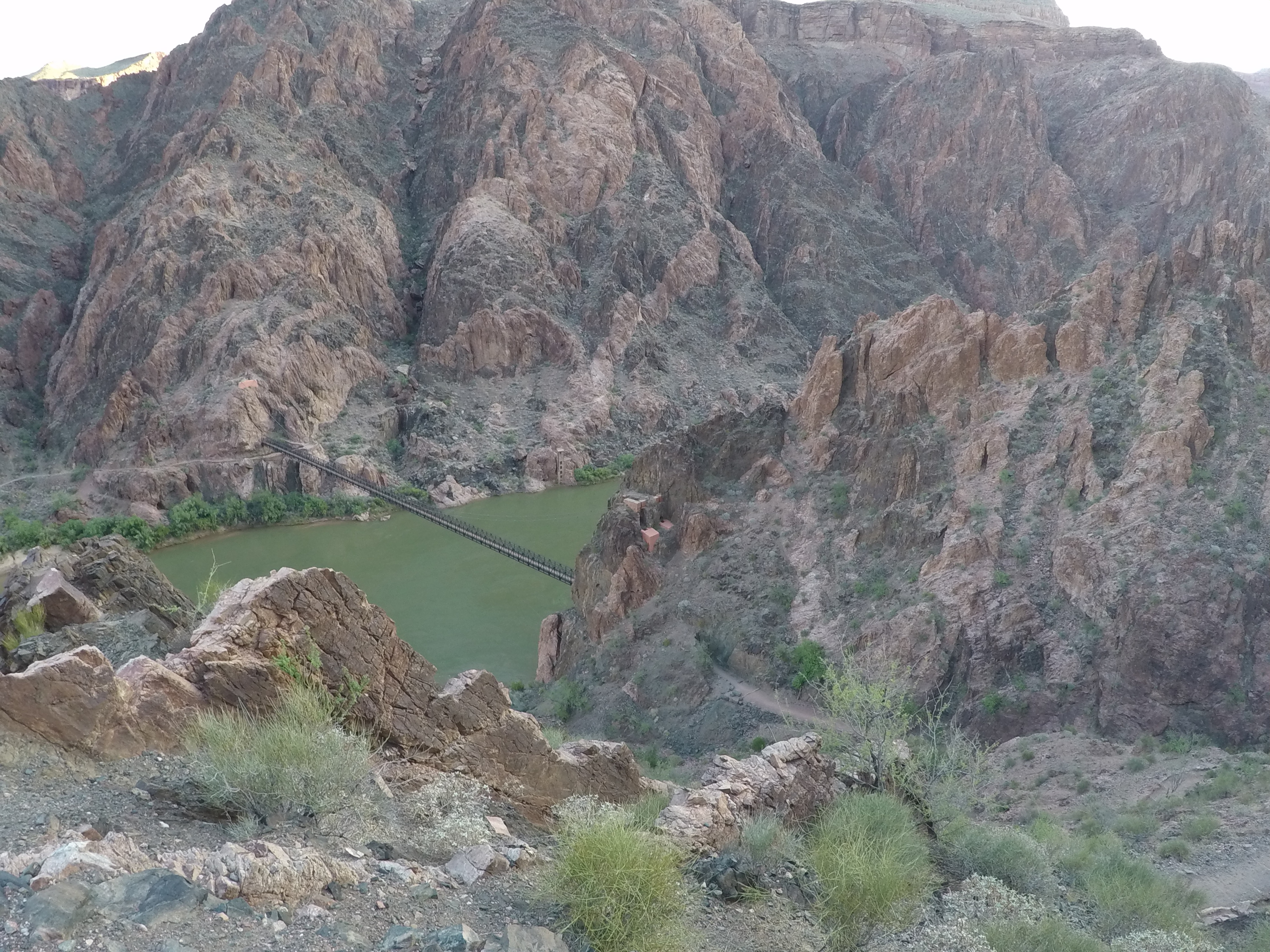
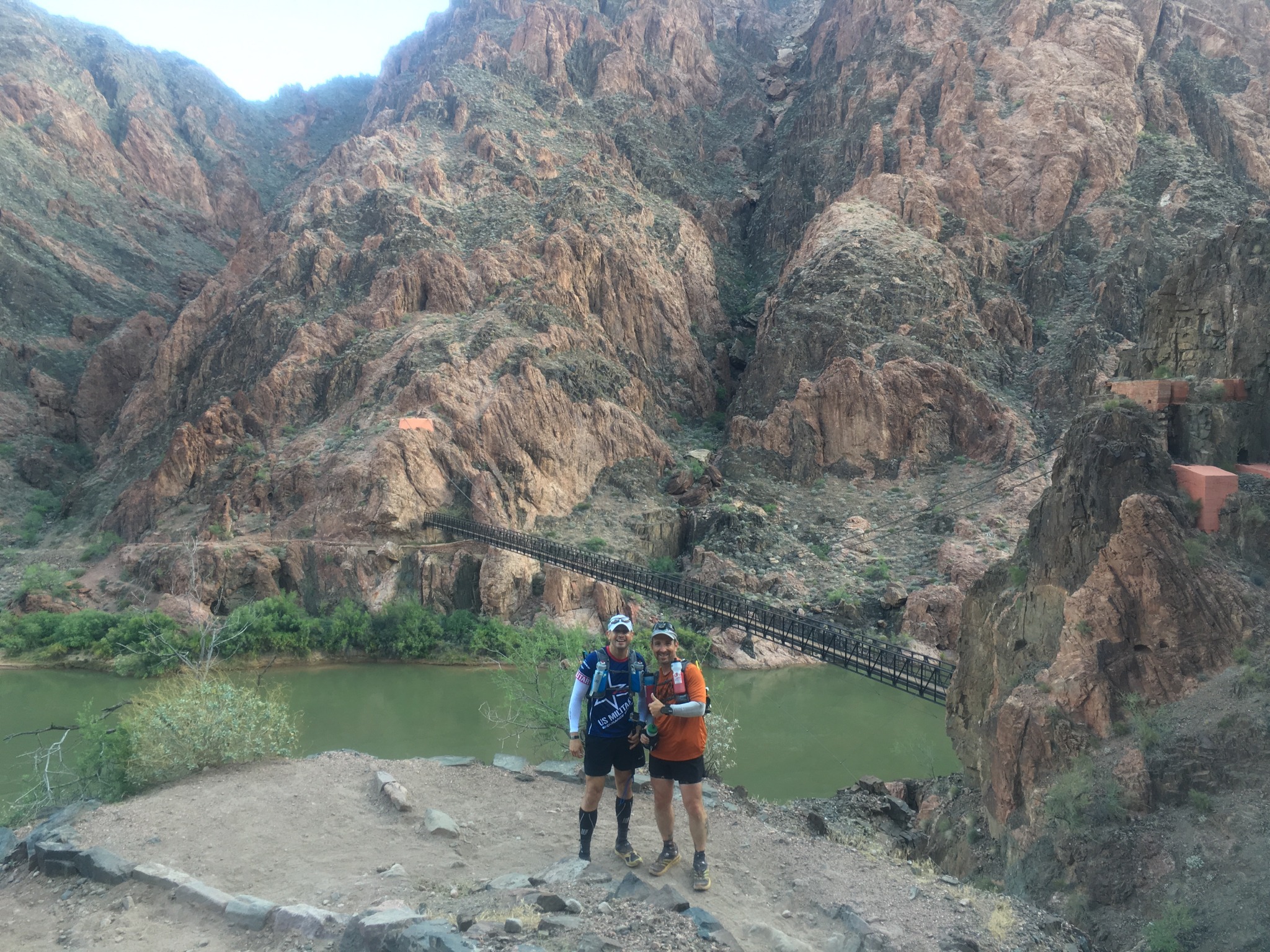
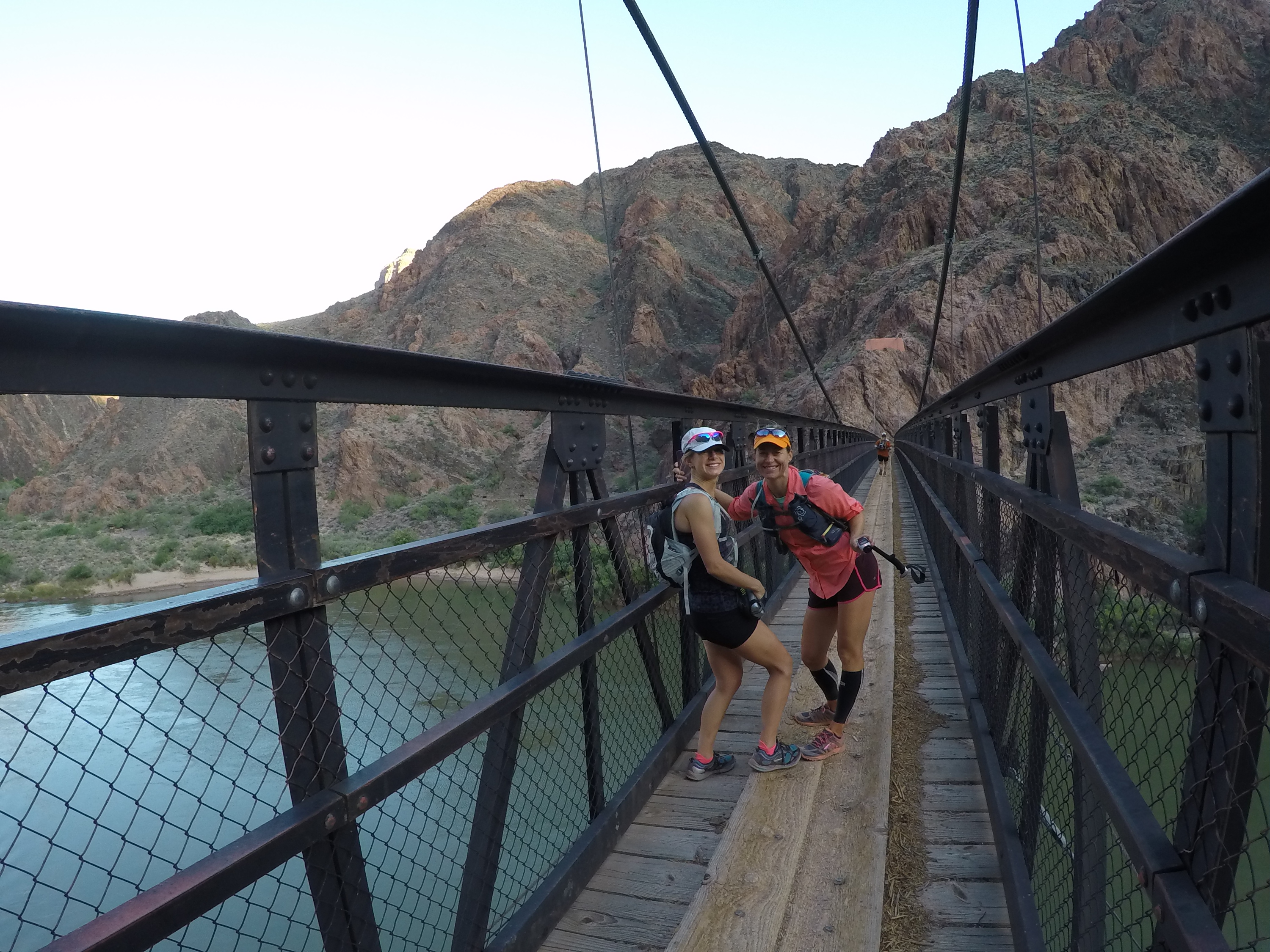
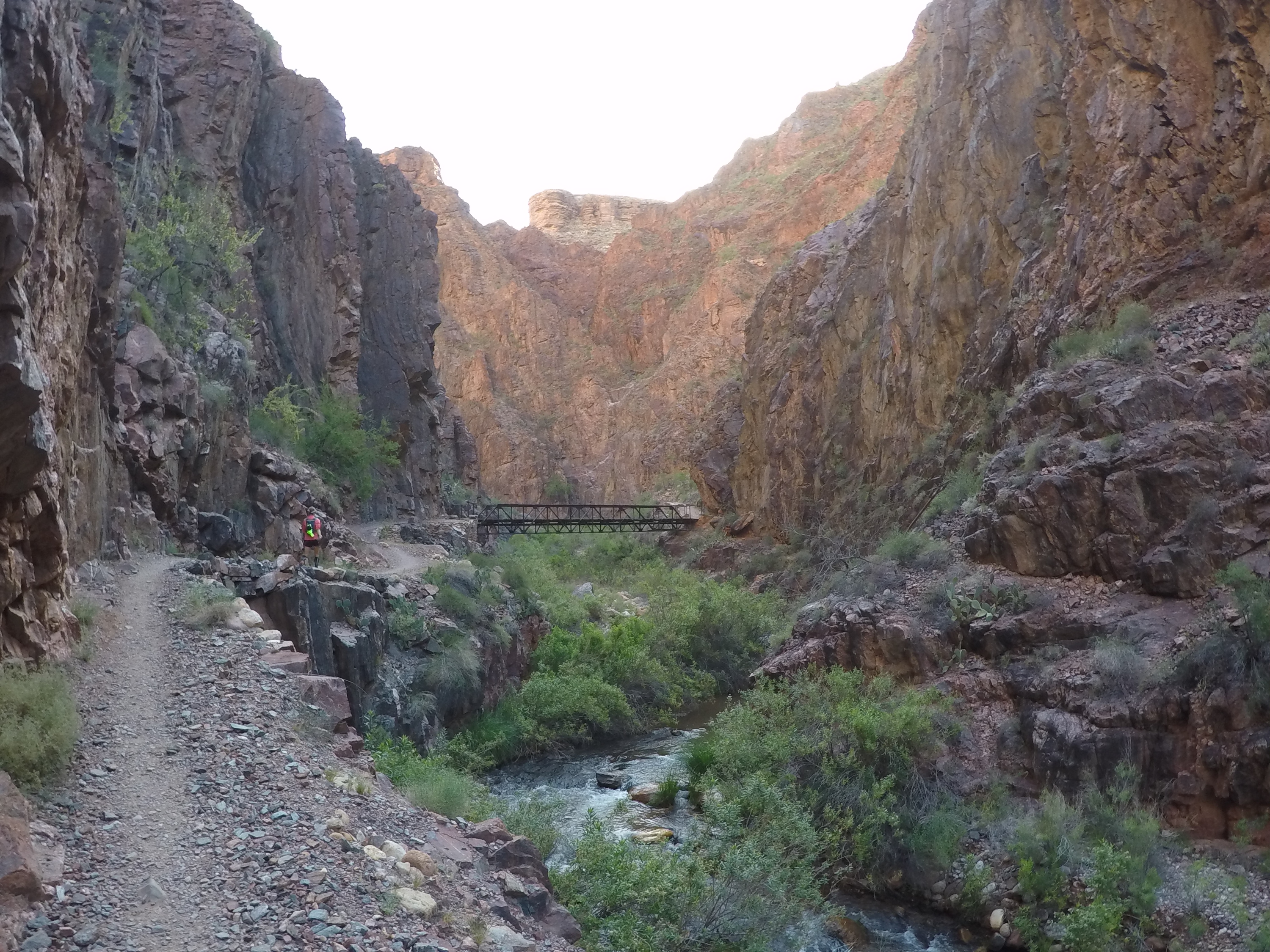
We all celebrated a little as we crossed the black, steel bridge, each of us snapping photos, taking video, and joking about how we accomplished more before 6:30am than most people do in an entire day. Once across the river, we came across our first water point. Everyone was sure to fill up since we had just over 7 miles, and 1,600 feet of climbing before our next stop at the Cottonwood Campground. I was carrying two 20 oz bottles, and decided to fill up my 1 liter collapsible bottle as well.
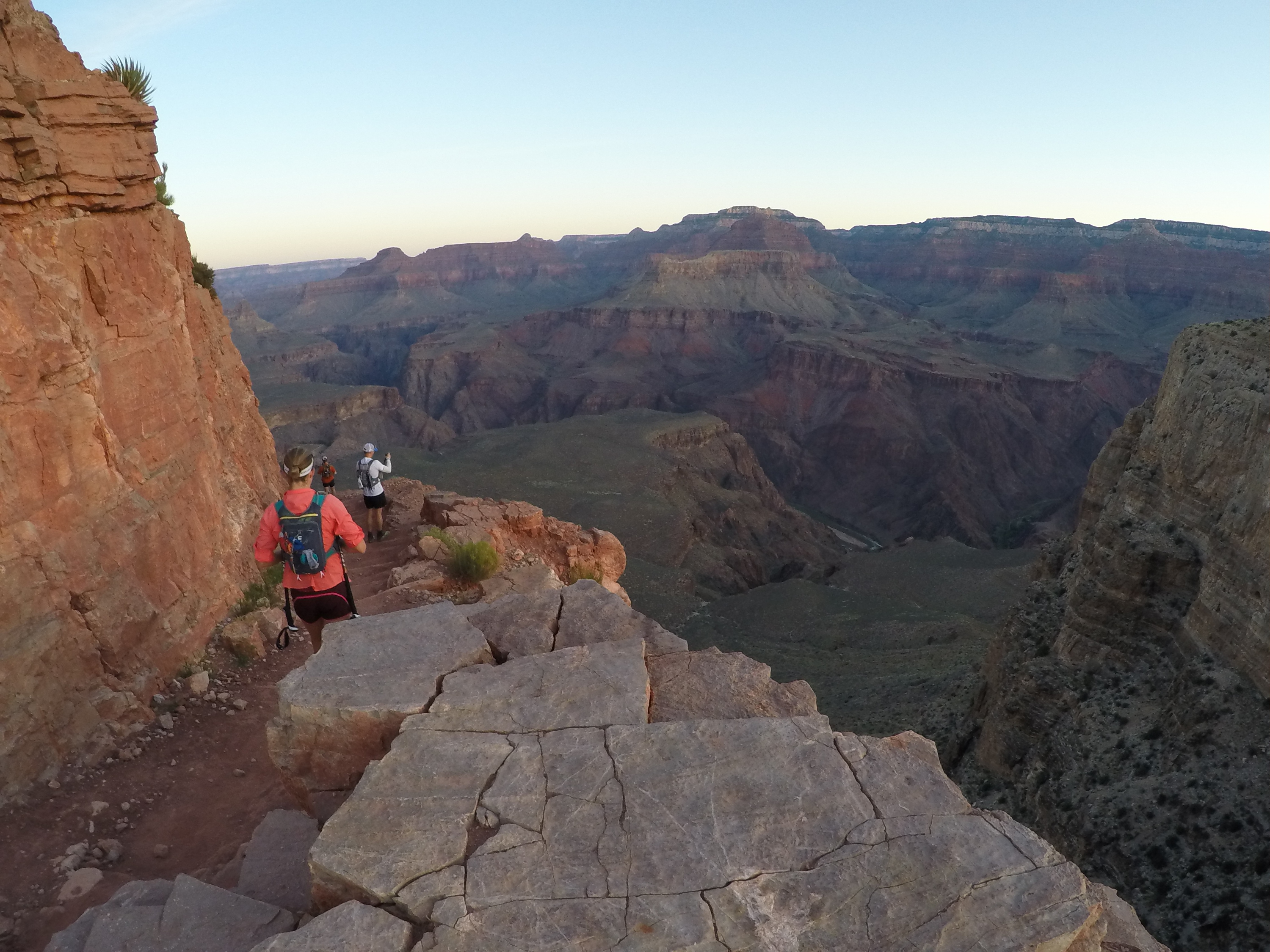
With a multitude of athletic abilities in our group, it reminded me of the Breakfast Club… the elite triathlete, the super fast marathon runner, the accomplished ultra runner, the jack of all trades/master of none, and Dewey. To this point, we had all stayed together for the most part. Runners would get ahead, then stop to wait for the rest of the group. However, we knew this would not last long since we had all agreed to “run our own race”. In other words, go with the pace that is comfortable for you. Most ultra runners are familiar with the agony that comes with hours of spending time in a stride other than your own. Since Lori is obviously part gazelle, she was the first to slowly peel away from the group. Before we knew it, she was completely out of sight, and wouldn’t be seen again for hours. The rest of the group began to space out, but was usually within eyesight of each other. From time to time, we would play leapfrog as someone stopped to take photos or video.
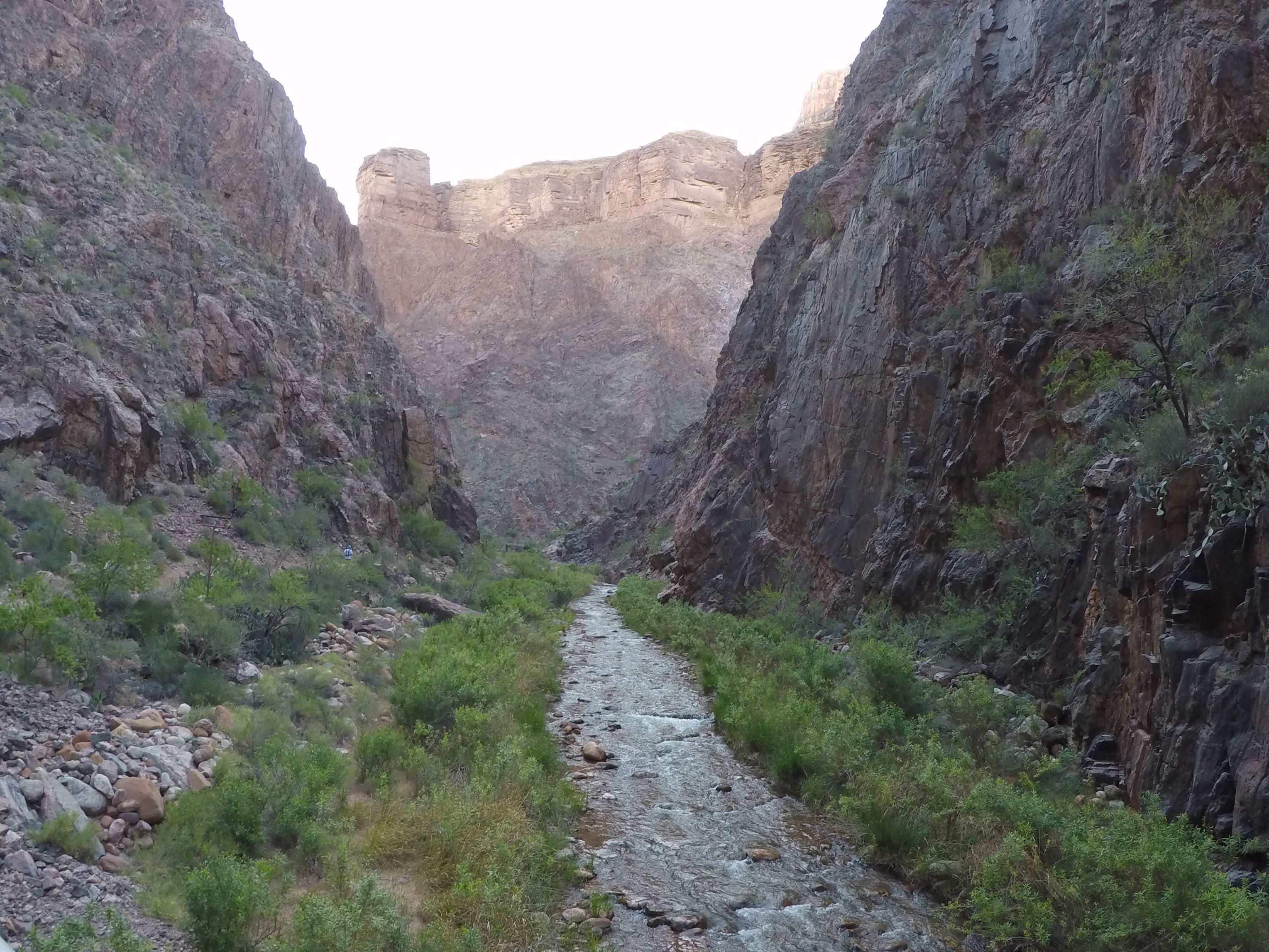
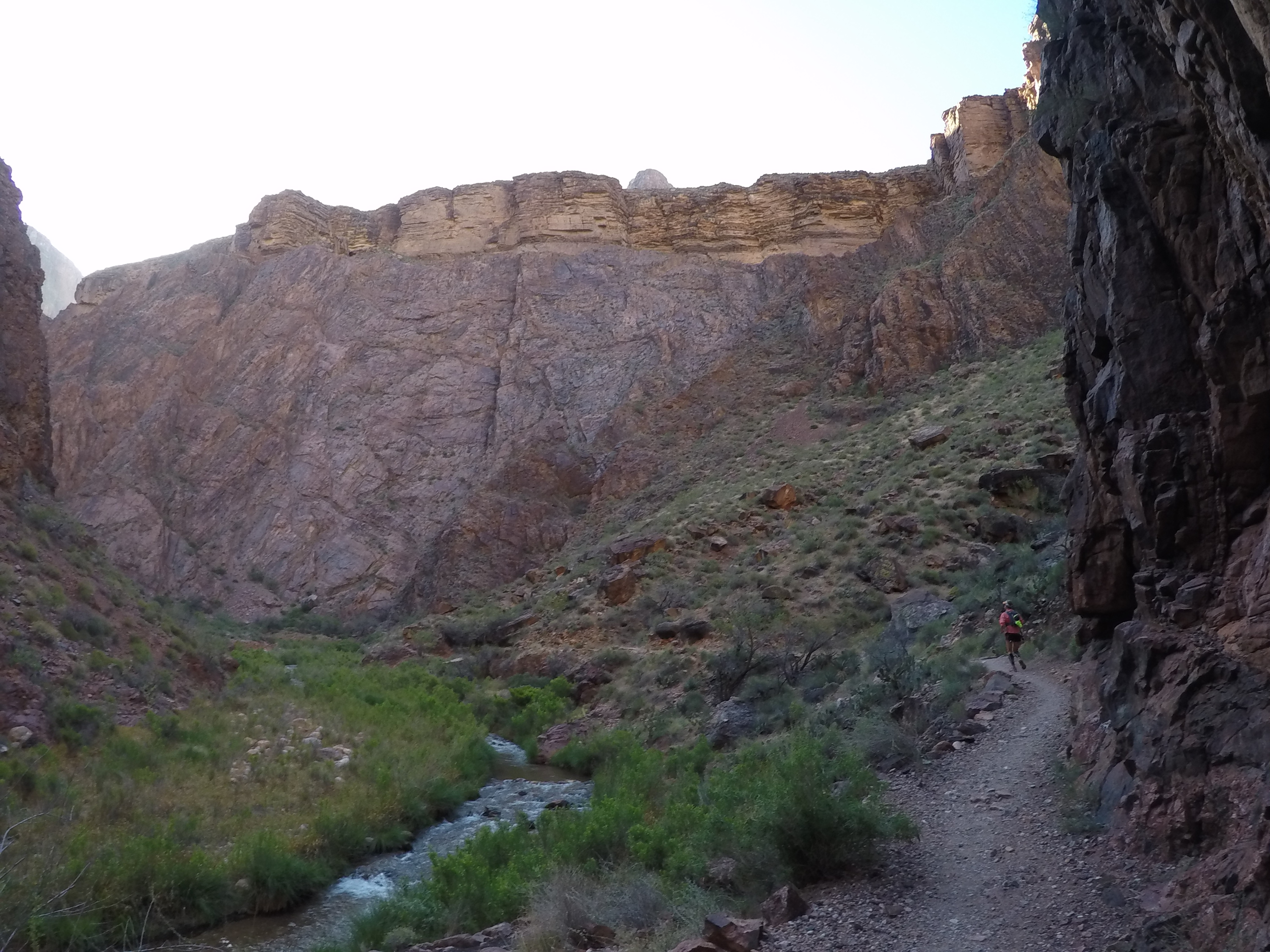
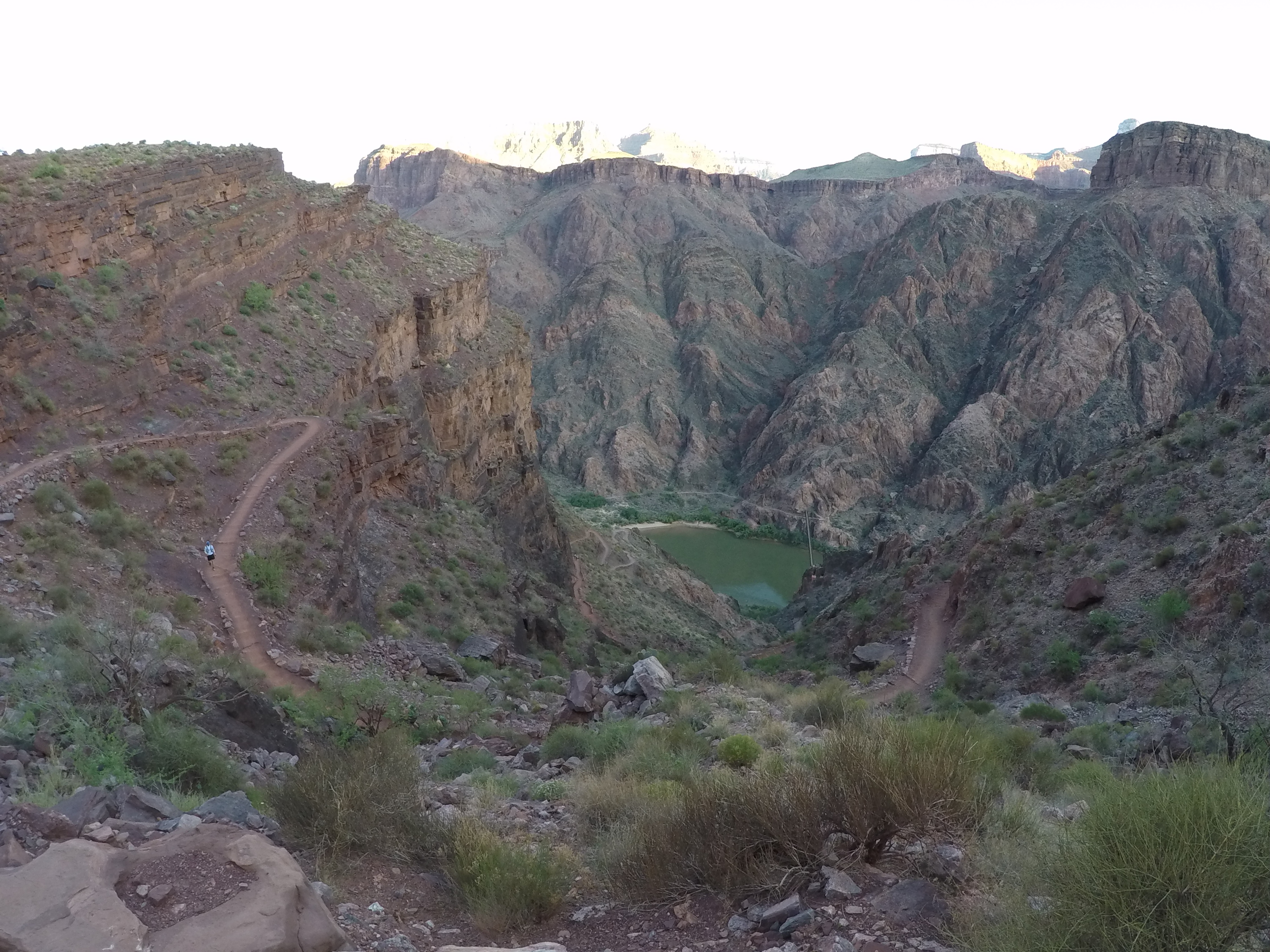
We continued up the trail as it followed the creek, and eventually made it to the Cottonwood Campgrounds (4,080 feet, 8:42am). I had made it the 7.2 mile stretch and didn’t come close to needing my spare 1 liter bottle in my pack. Once we heard that all of the water stations were operational, I opted to drop the weight and continue on with my two 20oz bottles. I knew this was somewhat of a gamble, but I had plotted the mileage and remaining water points left on the North Kaibab trail, and I felt it was worth the risk. It was at the Cottonwood Campground that we opted to break out our trekking poles. I had done VERY little training with poles, so I wasn’t sure what to expect. We packed up and pressed on.
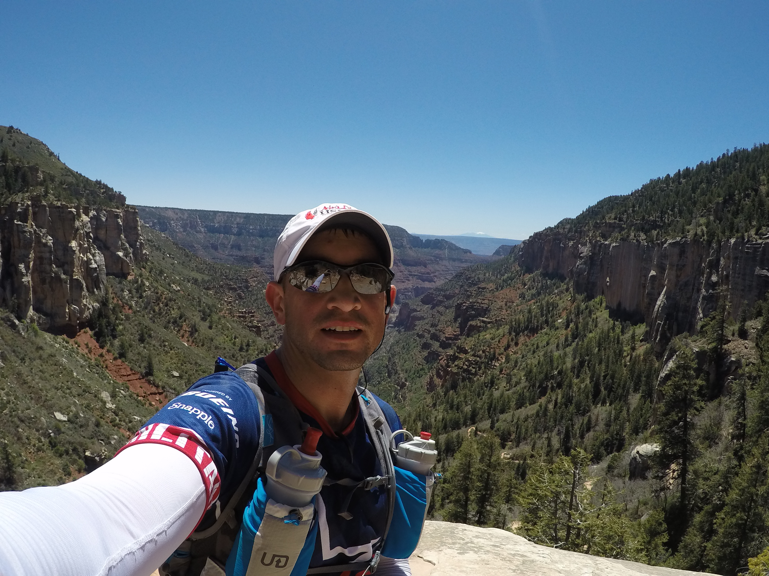
It was getting quite warm, just like we knew it would. I was hoping to feel cooler air as we climbed, but it just kept getting warmer. I continued to eat and hydrate on a regular basis; I knew the dangers of falling behind on either. The trail began to get much steeper, and I was VERY glad to have the trekking poles. I didn’t realize how much weight they can take off your legs! However, I hadn’t prepared for the arm/back workout I was about to receive with said poles. I quickly learned how to use them to my advantage as I continued to climb the rock and log steps, transferring my weight to my arms and giving my quads a bit of a break. I would switch on the GoPro and snap a few photos or take some video from time to time, but not near as much as I did while we were descending South Kaibab. I was already starting to wear out.
A friend told me I should have two-thirds of my energy left once I reached the North Rim if I wanted to have a successful run. That bit of advice kept playing over and over in my head as I told myself I had already passed that point. Every time I got discouraged or worried, I dropped my head, took a deep breath (or tried to at least), and pushed on. The term “forward progression” could have been the theme of the day, I probably said it about 400 times. I could lie to my running mates, but I couldn’t lie to myself; I was already exhausted.
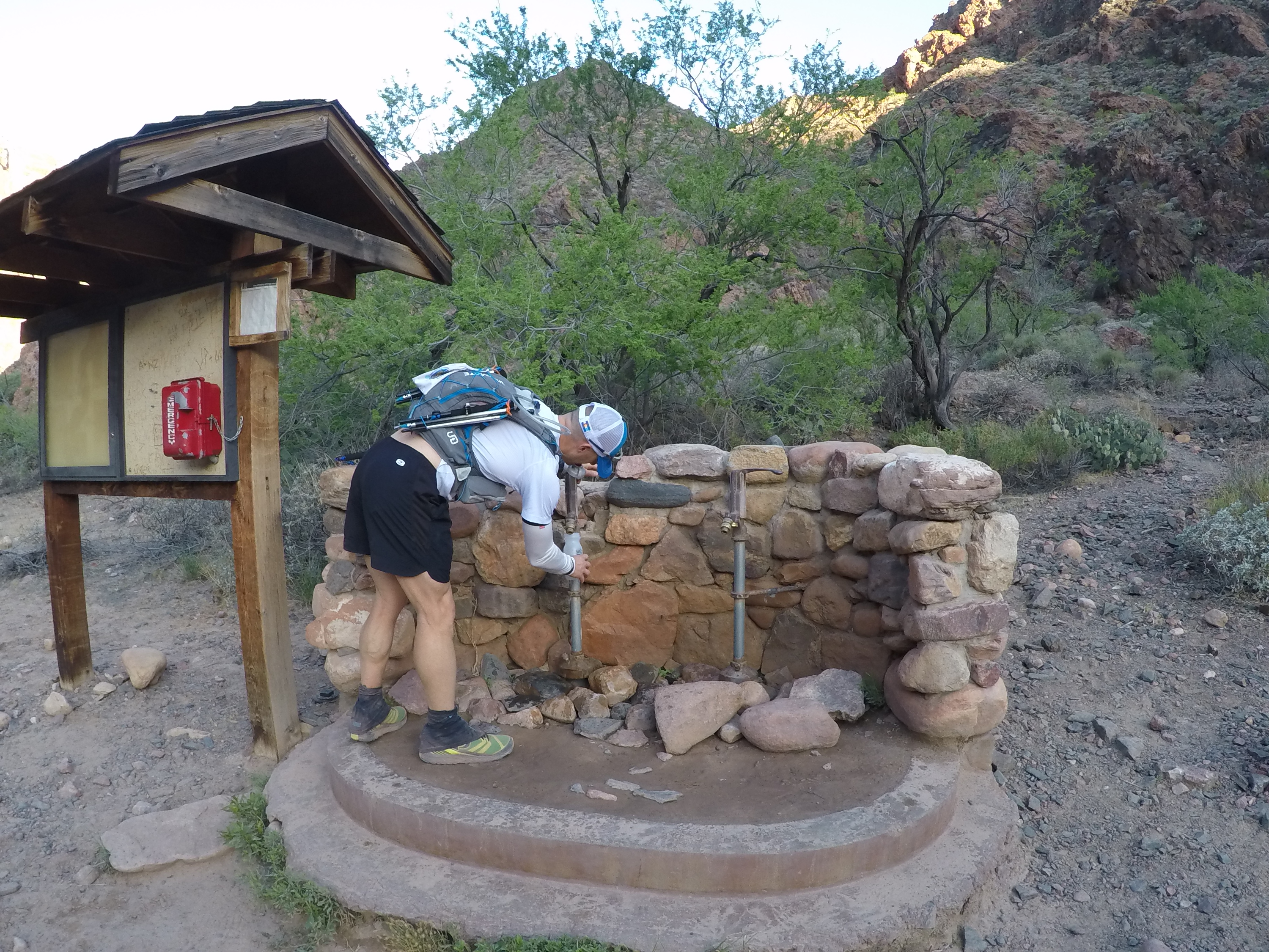
We stopped at the Pumphouse Residence (4,600 feet, 9:30am), dropped our packs, and doused ourselves in the cool water flowing from the spigot. It was then I realized how fortunate I was to be wearing the arm coolers. For anyone who hasn’t used them before, not only do they keep the sun off of you (mine are SPF 50+), they do a great job dissipating heat, especially when you soak them with water. The only way I can explain it is like air conditioning for your arms. I continued to eat and drink, but I was quickly loosing track of how much. At this point I had burned about 2,000 calories, so I did my best to remind myself (and others) to continually snack and drink. As much as I wanted to hang out and rest, it was time to move forward. We topped off, packed up, and moved on.
I was still having issues keeping my heart rate under control. Why is that so important? I’m no rocket surgeon, but here is the best way I can explain why keeping your heart rate low is important. When you heart rate is low, you burn mostly fat. Since the majority of us have plenty to burn, you are less likely to hit “the wall”. As your heart rate rises, it begins to burn more and more of what is in your gut. This is because burning carbs is easier than burning fat, and your body wants to be as efficient as possible. The higher your heart rate goes, the more carbs you burn. Eventually, you can get to the point where you are only burning carbs, which are not a limitless supply. If your heart rate continues to rise, your body goes into fight or flight mode. It starts to freak out and makes the decision to use all of its energy to make your muscles work, which means it stops processing food. As an ultra runner, my goal is to find the happy medium between carb and fat burn, without ever getting to the point that I stop processing food. This is probably a very crude way of explaining it, but you get the point.
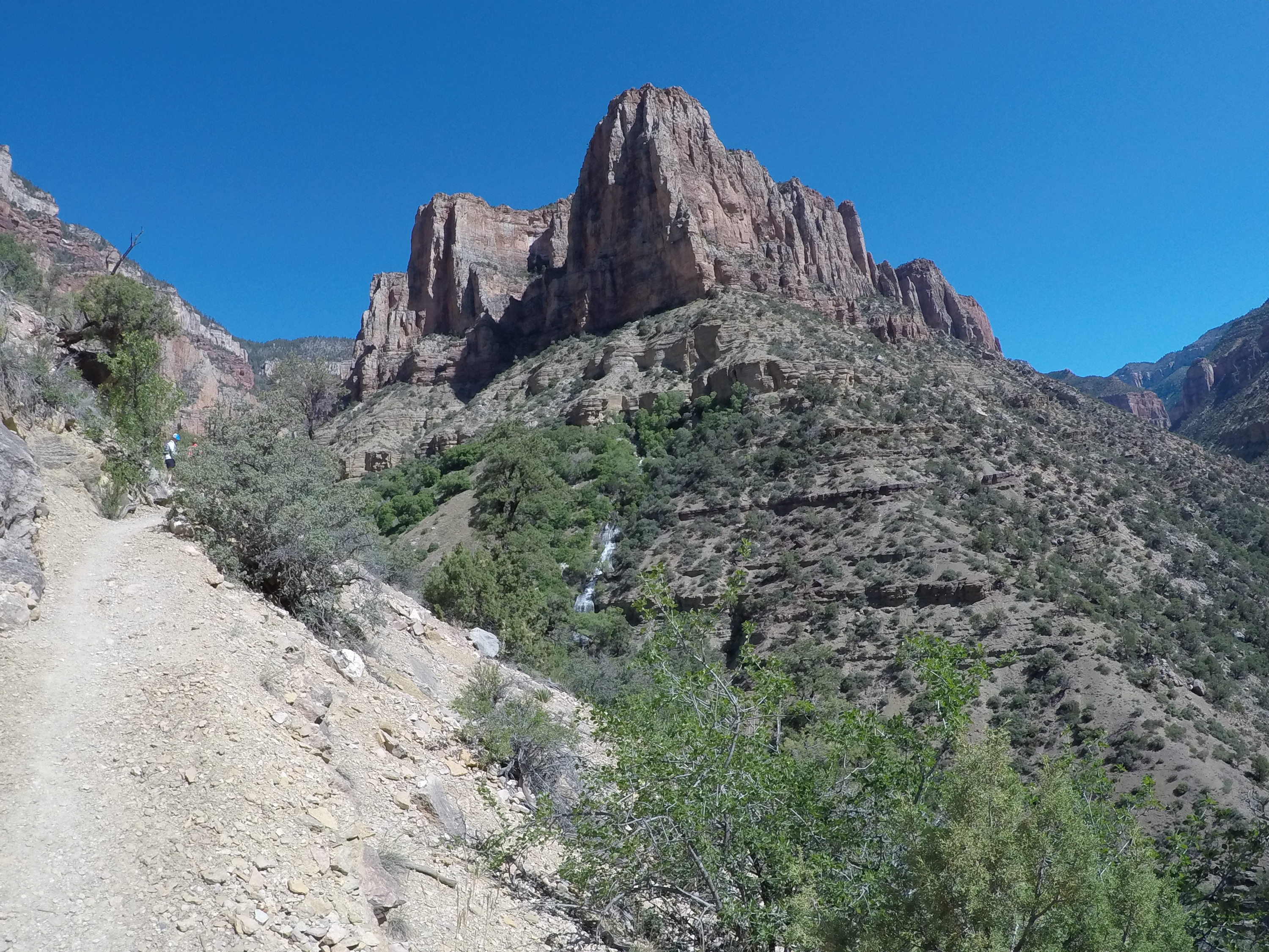
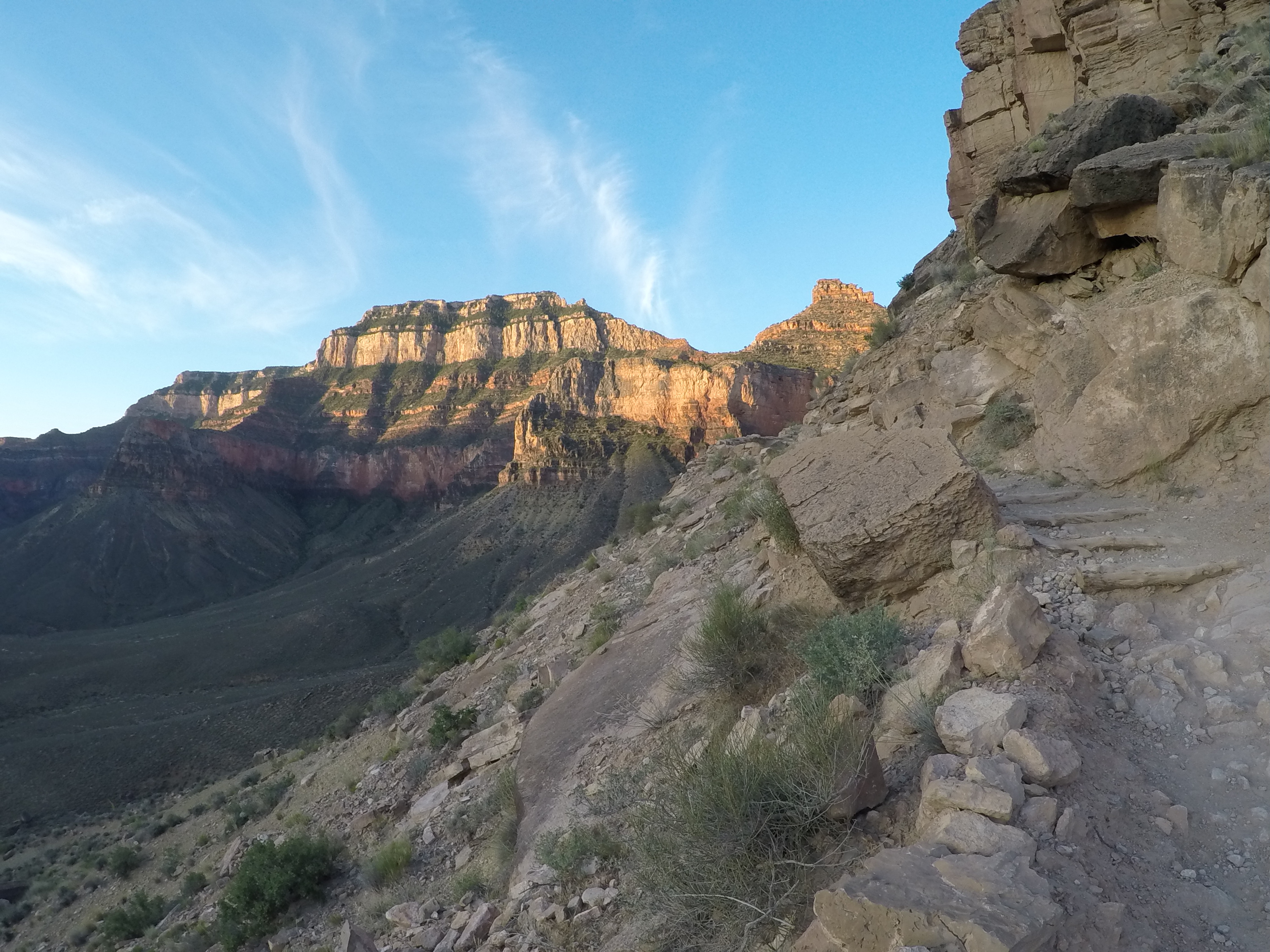
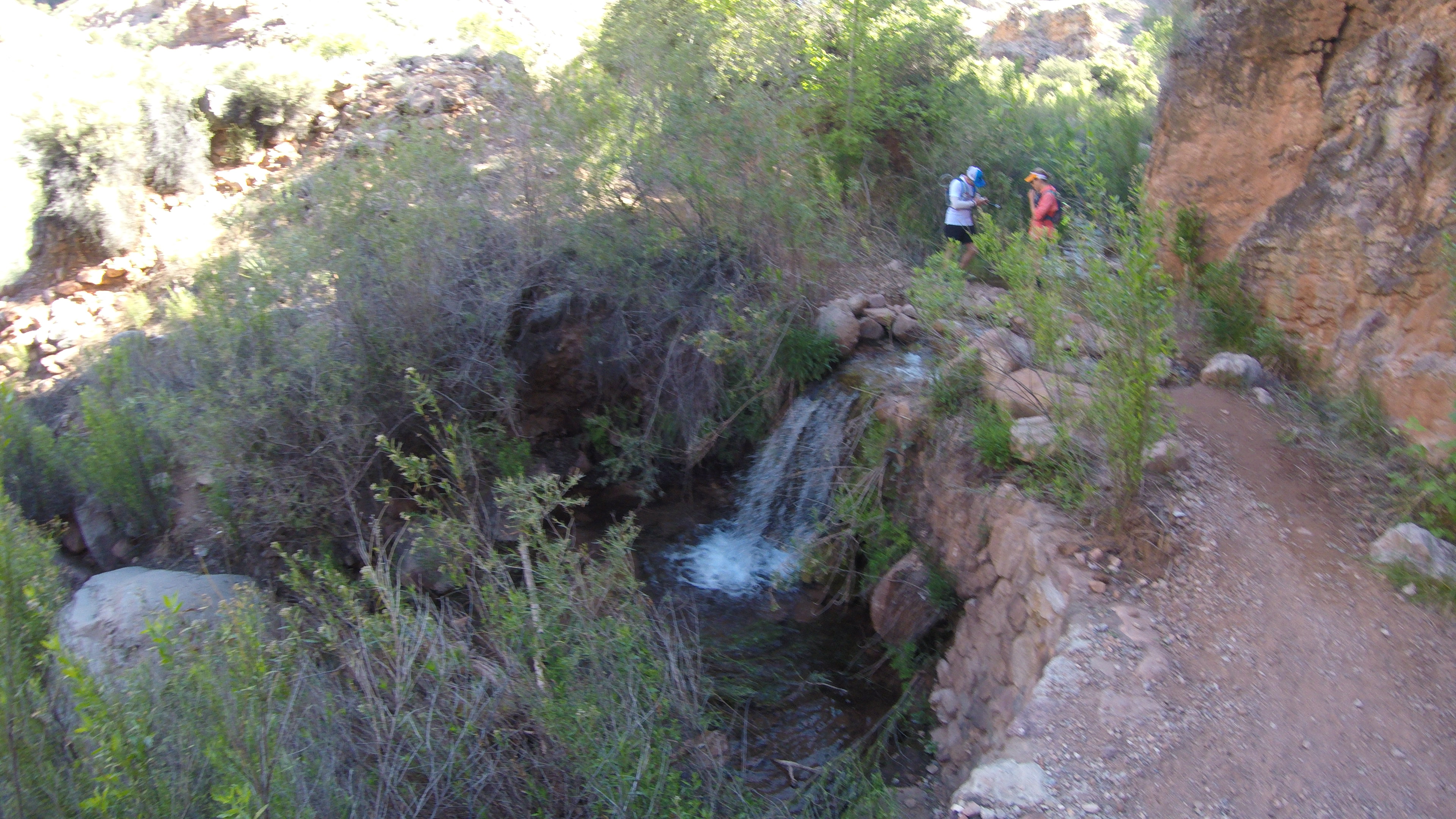
Next stop was Roaring Springs. As we continued up the trail, we finally saw the waterfall across the canyon. As we got closer, we noticed the building and helipad at the base of the waterfall, and came to the conclusion it was Roaring Springs (5,220, 9:45am). What we weren’t ready for was the requirement to depart the main trail to get to the springs. Those of us remaining in the group all had enough water to make it to Supai Tunnel, so we made the decision to press on. We felt it was unnecessary to add additional mileage if it wasn’t required (which is also why we didn’t visit Ribbon Falls).
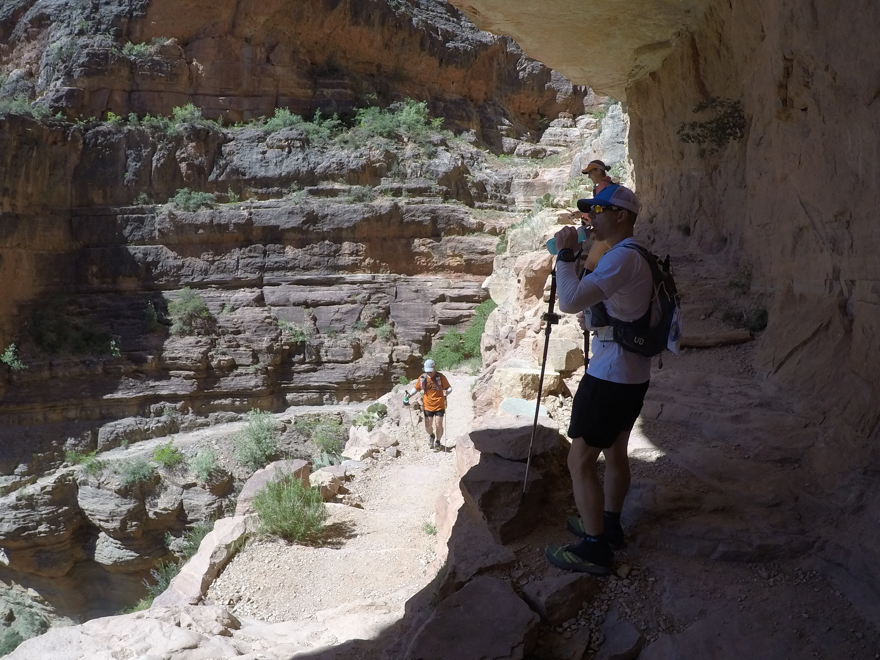
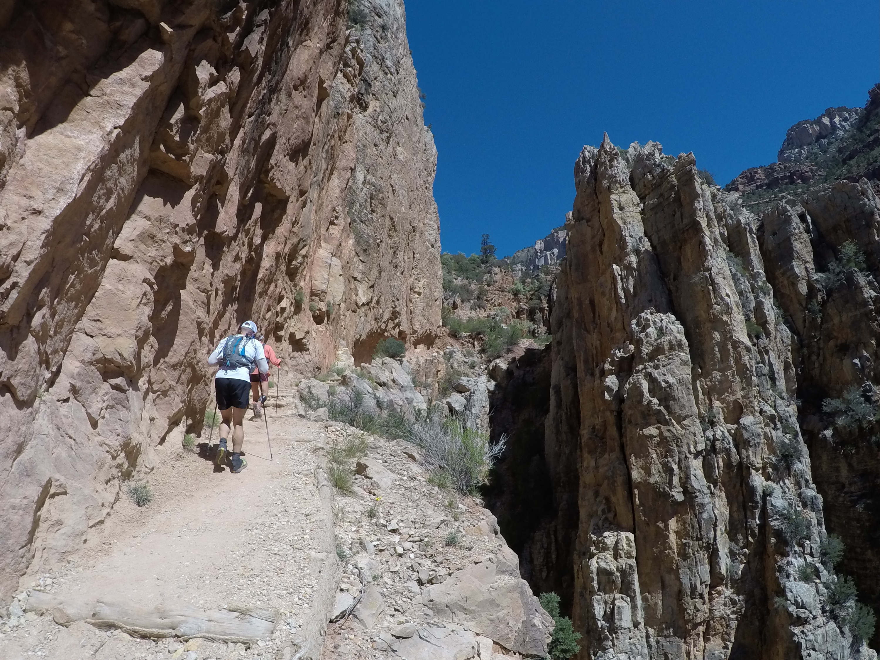
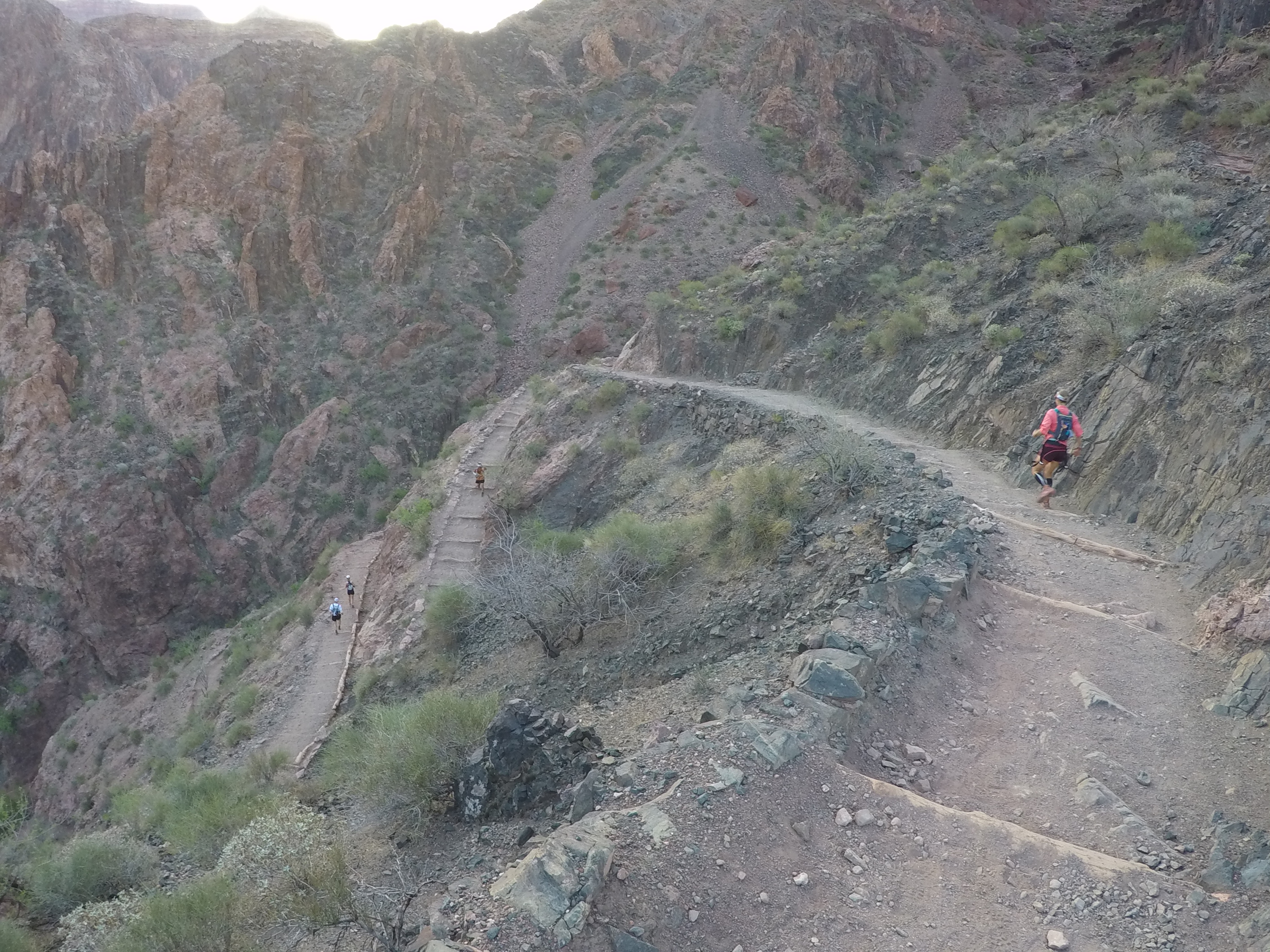
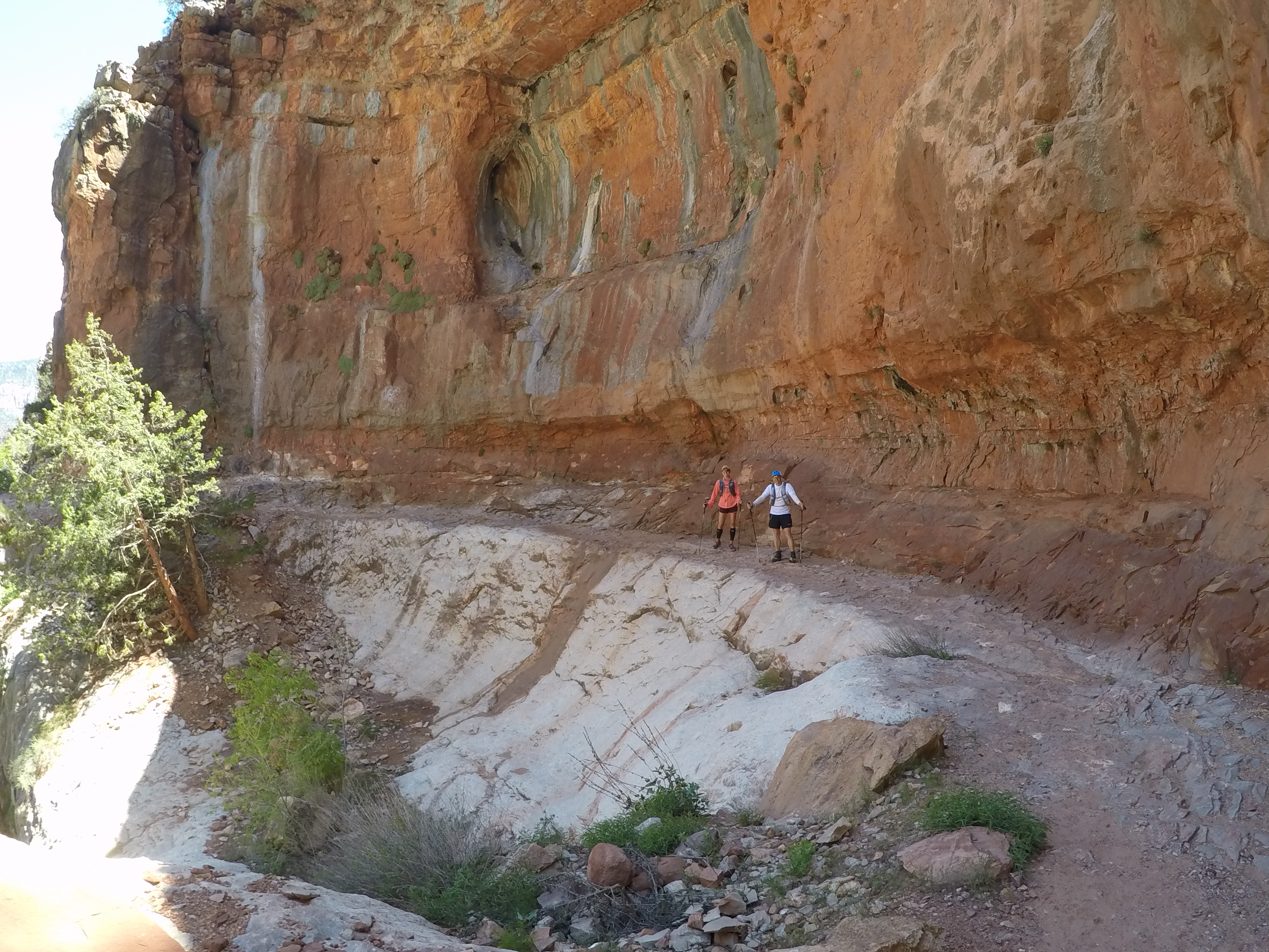
Just like the trail, we continued on. Up and up we went, with no end in sight. I continually thanked myself for purchasing my Black Diamond Z Poles for Christmas; I honestly don’t know how well I would have faired without them. By this point, temps had probably reached into the mid 80’s, and I couldn’t wait to get to the top to feel that cool mountain air. I had a “cheat sheet” in my pocket with all of the distances between water points, and elevation changes; but that only caused more distress. Since GPS is so crazy within the canyon, the mileage can vary quite a bit. It seemed like an eternity had gone by, but we just couldn’t find Supai Tunnel. We climbed, climbed, climbed…. then we climbed some more. Did I miss something? Did I take a wrong turn? Where the hell is this damn tunnel?! The trail got steeper as we settled into the dreaded switchbacks, and I knew we were getting closer. Although we were spread apart by 50-100 yards, the switchbacks allowed us to keep an eye on each other.
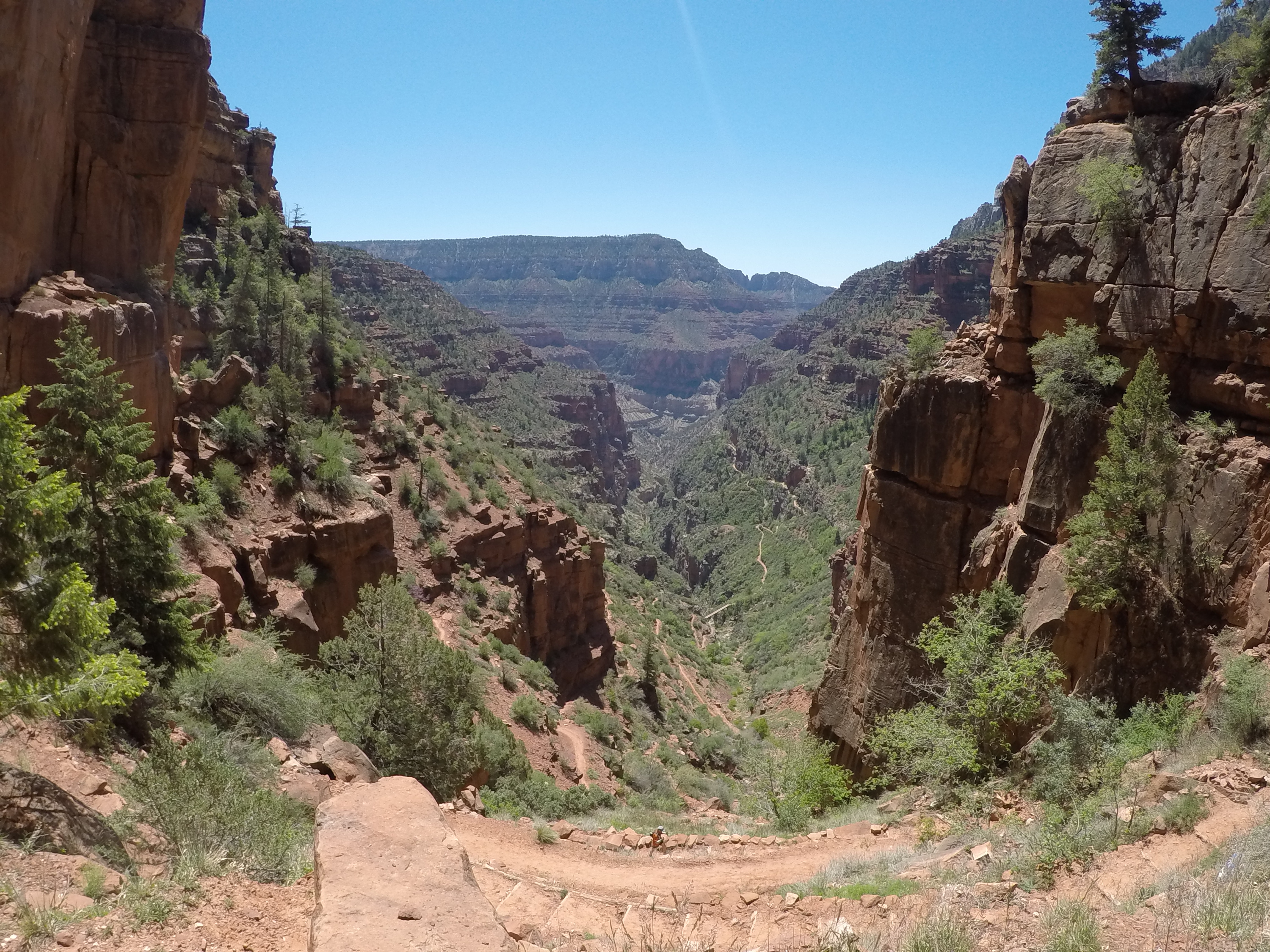
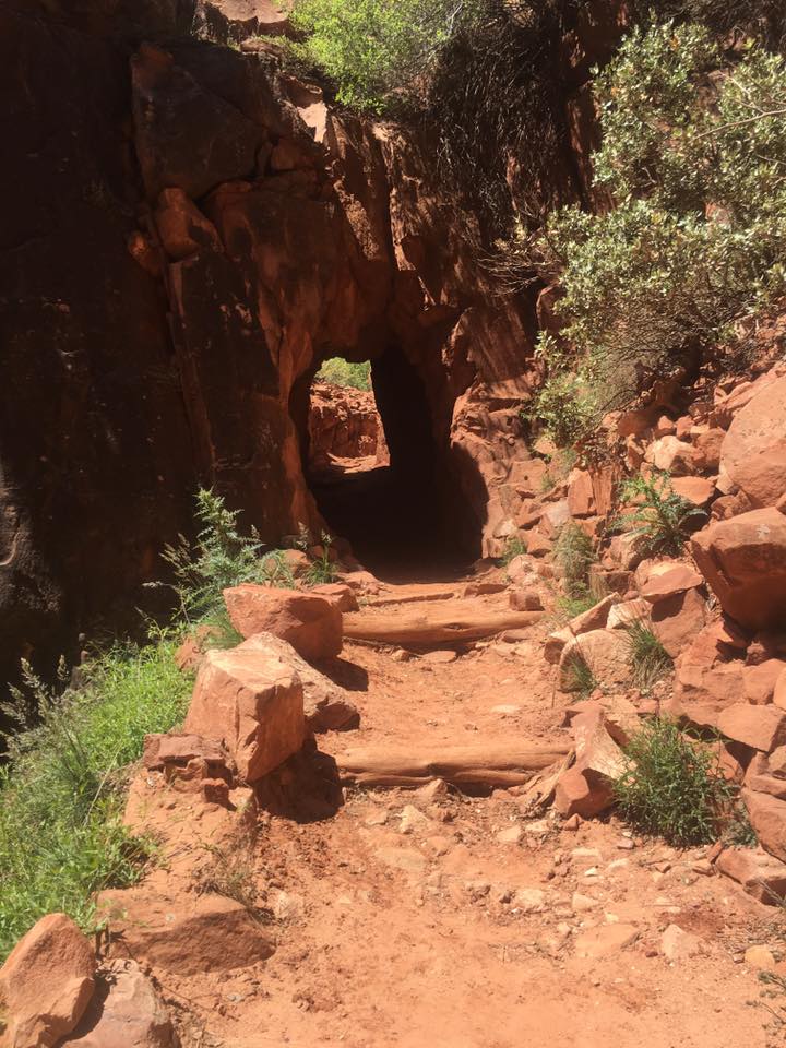
As the pine trees began to appear, so did the tunnel. It’s not just a catchy name, it is a tunnel carved into the mountain. I celebrated inside as I knew the rest stop was just on the other side. We had finally made it to Supai Tunnel, last stop to the top (6,800 feet, 11:30am). As we sat in the shade, shoved food in our face, and refilled our bottles, we were pestered by deer flies as they continually fed on us like buzzards on a carcass. No matter how much you waved them off, they always returned like a lost puppy…. a bloodthirsty lost puppy. It was time to move on.

By this point I had given up on trying to keep my heart rate down. Instead, I concentrated on the real priorities of fuel and hydration. I continued to snack and take sips, anything to keep my mind off this never-ending climb. The temperatures had gotten a bit cooler, but sometimes you don’t really notice it when you are working that hard. Just prior to reaching the Supai Tunnel, we had come across a lone hiker as he made his way down the trail. We asked if he had seen our friend, Lori (the gazelle), he said he did. He also said she was probably an hour ahead of us. Well, we finally met up with her as she was descending. Her first words to me was how grateful she was to be doing this and how great of an idea I had… at least that is how I remember it. Ok, maybe it was the opposite of that with some cursing peppered in, but either way, she looked strong and was making great time (unlike the rest of us). I didn’t want to lose too much mental momentum, so I told her good luck and we parted ways again. We wouldn’t see her again until the adventure was over.
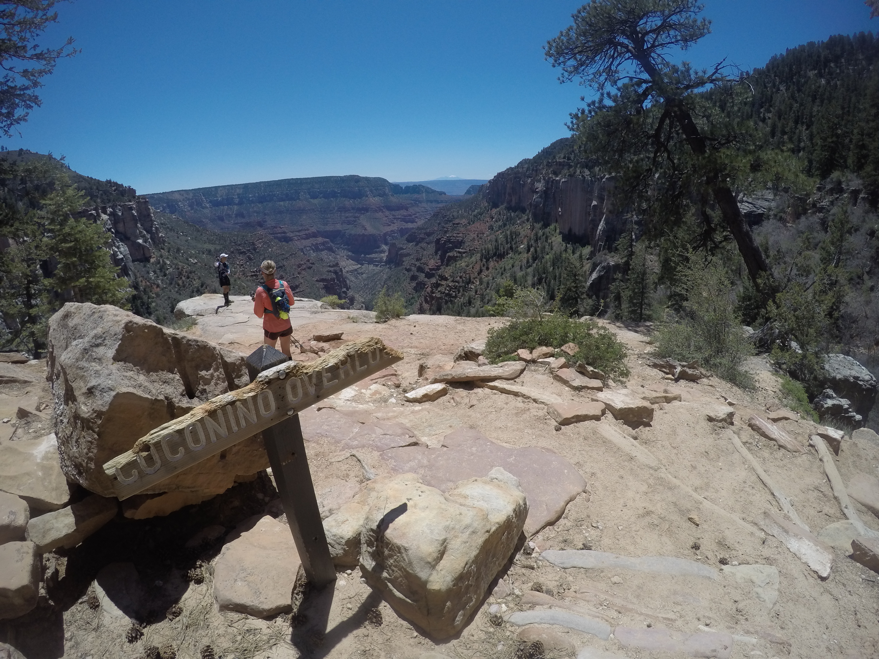
We made our way deeper into the pines and came across an amazing view, the Coconino Overlook (7,700 feet, 12:05am). This was a great energy boost as we put on pain-free smiles for the camera and took plenty of photos and video. This was another good opportunity to look down the trail to make sure everyone was still moving. All present and accounted for… time to stick a fork in this thing.
It was only a matter of minutes before I looked up and saw Jamie looking back at me with a huge grin on her face; we had reached the North Kaibab Trailhead (8,241, 12:30am). Yet another celebration, a few high fives, and smiles were plastered on everyone’s face. Unfortunately, all of this was short lived. The euphoria of reaching the top started to wear off as we began to discuss the trip back down the mountain. As if that weren’t enough, the deer flies from Supai Tunnel must have told all their friends we were coming, because they were out in force! You had to keep moving or risk getting eaten alive by the little bastards. For those who have not experienced deer flies, these hellions are like miniature vampire bats; they bite you and lick the blood. Gross.
I think we spent about 15-20 minutes at the NKT, eating, chatting, hydrating, and using the restroom. Since the North Rim wasn’t open, there was very little traffic. In fact, we had only seen about half a dozen hikers and zero runners since we left Bright Angel Campground. I actually really enjoyed the solitude. Everyone packed up their stuff, topped off their water bottles, and departed the North Rim (8,241, 12:45pm).
Since we had already seen this entire trail before, very few photos and videos were taken on the way back down. My body and mind were both fatigued, and the thought of trying to work the GoPro sounded exhausting (that’s when you know you are tired!). However, I was glad to be working different muscles! We picked up the pace as we started our descent, but opted to keep the poles out as they provided a little extra stability; plus it wasn’t very taxing to carry them. It seemed like only twenty minutes or so and we were back at Supai Tunnel (6,800 feet, 1:30pm). Again, we soaked ourselves with the cool water, ate more food, and regrouped. One topic of discussion was the fact that our pre-reserved sack lunches at Phantom Ranch may not be there when we arrive because the kitchen closes at 4pm. This had us pretty worried because we had factored that into our caloric intake for the day, and it could set us back a bit. It was at Supai Tunnel I decided to pick up the pace and see if I could make it to Phantom Ranch in time.
The miles were ticking away, and my quads were throbbing. I tried to enjoy some of the sounds of nature on the way up, but I opted to crank some tunes on the way down. Although I was sore and tired, moving somewhat quick actually felt really good. I passed by Roaring Springs (5,220 feet, 2:10pm), and made it to the Pumphouse Residence (4,600 feet, 2:30pm). The plan was to fill my bottles and continue my quest to get to Phantom Ranch before 4pm… but who was I kidding? My legs didn’t have much left in them, my heart rate was above my usual marathon race rate, and it was getting warmer every minute. As I stepped into the rest area near the spigot, I heard the on-duty ranger chatting on her phone. When she hung up, I asked about the kitchen at Phantom Ranch. She was kind enough to call them and ask their policy on after hour sack lunches. As it turns out, you can pick them up at anytime using their side delivery window. What a relief! There was no point in bombing down the hill anymore, so I dropped my pack and soaked myself for the 37th time. As the other runners arrived, I shared the good news. We spent the usual 5-10 minutes pulling out more food for the next section, topping off bottles, and soaking ourselves before we continued our descent.
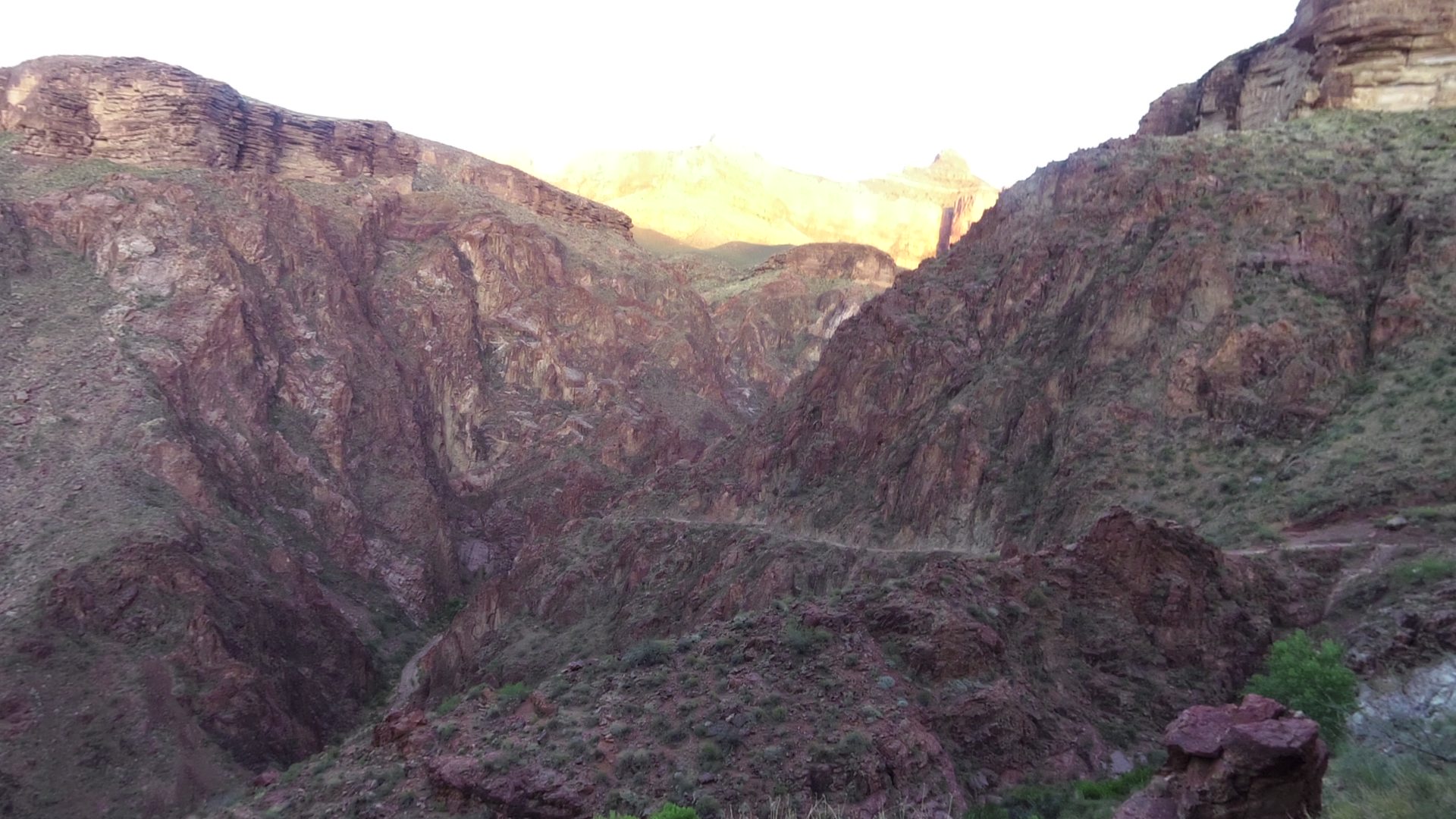
I could tell the trail had already taken its toll on everyone. The smiles towards the top of the North Rim may have been somewhat fake, but at least they existed. At this point, there weren’t many smiles. I personally came into this challenge with a goal of 15 hours. We had just passed the 10-hour mark, and there was lots of work left to do. I had never climbed Bright Angel Trail, so I had no clue how long it would take. However, I did know the remainder of the trip would take longer than 5 hours. So, I decided to change my goal from “completing the run in 15 hours”, to “surviving the canyon.”
What once felt good at the top of the North Rim, was now killing my quadriceps. Running downhill was bad enough, but having to step down 12-18 inches every 50 feet or so was destroying my legs. Luckily, I was able to put some weight on my trekking poles and save some stress on my leg muscles… every little bit helps! My pace had dramatically decreased from my earlier “run for lunch” pace, but I really didn’t care anymore; I was happy with forward progression. Anytime I was moving faster than a walking pace, my heart rate stayed above 160. I’m assuming it had to do with the elevation since it had been an issue all day, but I knew I couldn’t sustain that HR for another 7-8 hours, or however long it was going to take me to finish.
We arrived back at Cottonwood Campground (4,080 feet, 4pm), and boy was I happy to have some cool water! I attempted to do the math, but my brain wasn’t working right. We seemed to be moving at a fairly good pace, but we didn’t seem to be making up any time. I was discouraged, and I was hot. It had to have been in the low 90s already, and we still had some descending to do. However, I sure was glad I didn’t try to beat feet to Phantom Ranch, there is no way I would have made it by 4pm. We grabbed food out of our packs, topped off our bottles, and prepared ourselves for the 7.2 miles back to Phantom Ranch. I remember calculating how much water I drank during the same 7.2 miles earlier in the morning, and I “knew” 40oz would get me there safely.
As we left Cottonwood Campground, we fell back into our “slog”, or slow jog. I think that is properly defined as faster than a shuffle, but slower than a run. Either way, forward progression was the ultimate goal. Eventually, our slog turned into a power walk. We were exhausted, and with zero shade available, we were cooking under the hot afternoon Arizona sun. You could feel the heat radiating off the rock walls, like a massive toaster oven.
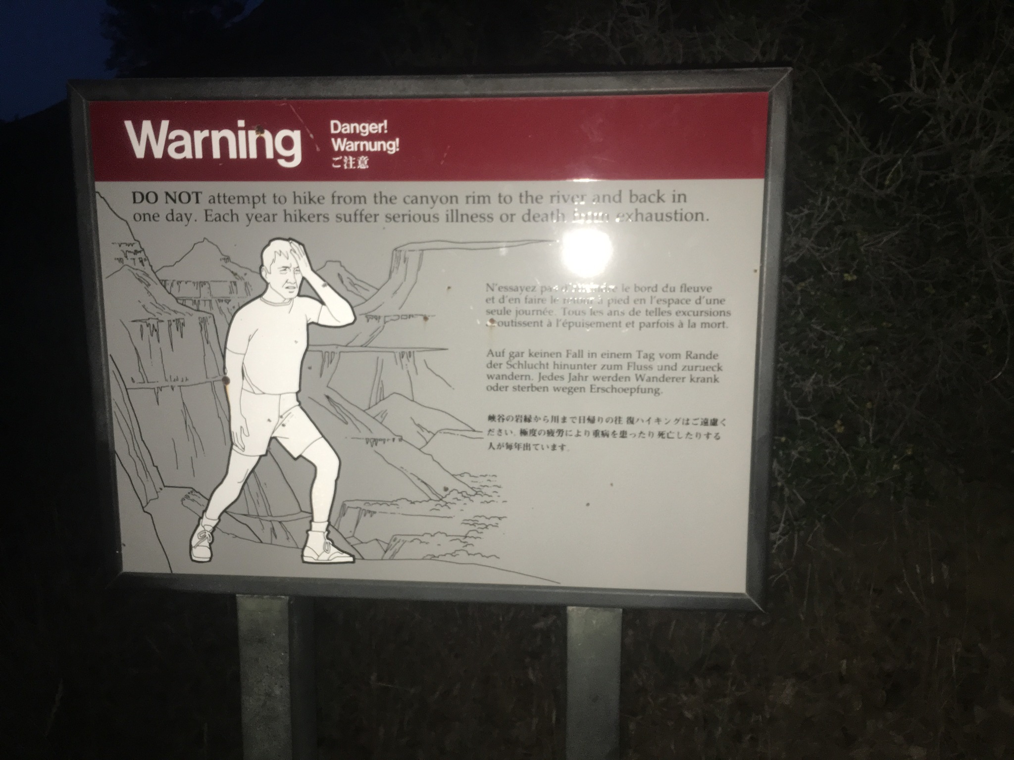
Leading up to the run, I had fears of becoming a statistic. Whether it was from passing out from heat stroke, or falling off the ledge, I didn’t want to be “that guy”. So, I was a little extra cautious throughout the day. During this period of intense heat, I made sure to continue drinking. According to my watch, it was right around mile 5 of the 7.2-mile stretch that I began to worry about running out of water. I went into conservation mode, and changed from gulps to sips. I apparently wasn’t the only one who had underestimated the 7-mile stretch; Jamie was also running low on water. Right around the time we sipped our last few drops, we came across some hikers. ”How far until Phantom Ranch?” we asked. “3.6 miles” they replied. IMPOSSIBLE! I knew for a fact that I had been tracking my mileage closely, and Phantom Ranch should be just around the next corner! Ladies and gentlemen, do not trust your GPS within the canyon walls. A quick look at my Garmin data after the run revealed huge mileage discrepancies, and the hikers were correct. However, this was not the time to trust some random hikers who have no idea what they are talking about. I kicked it into medium gear (high gear burned out hours ago), and pressed on. About 3 miles later (just as the hikers suggested), we finally arrived at Phantom Ranch (2,480 feet, 5:40pm).
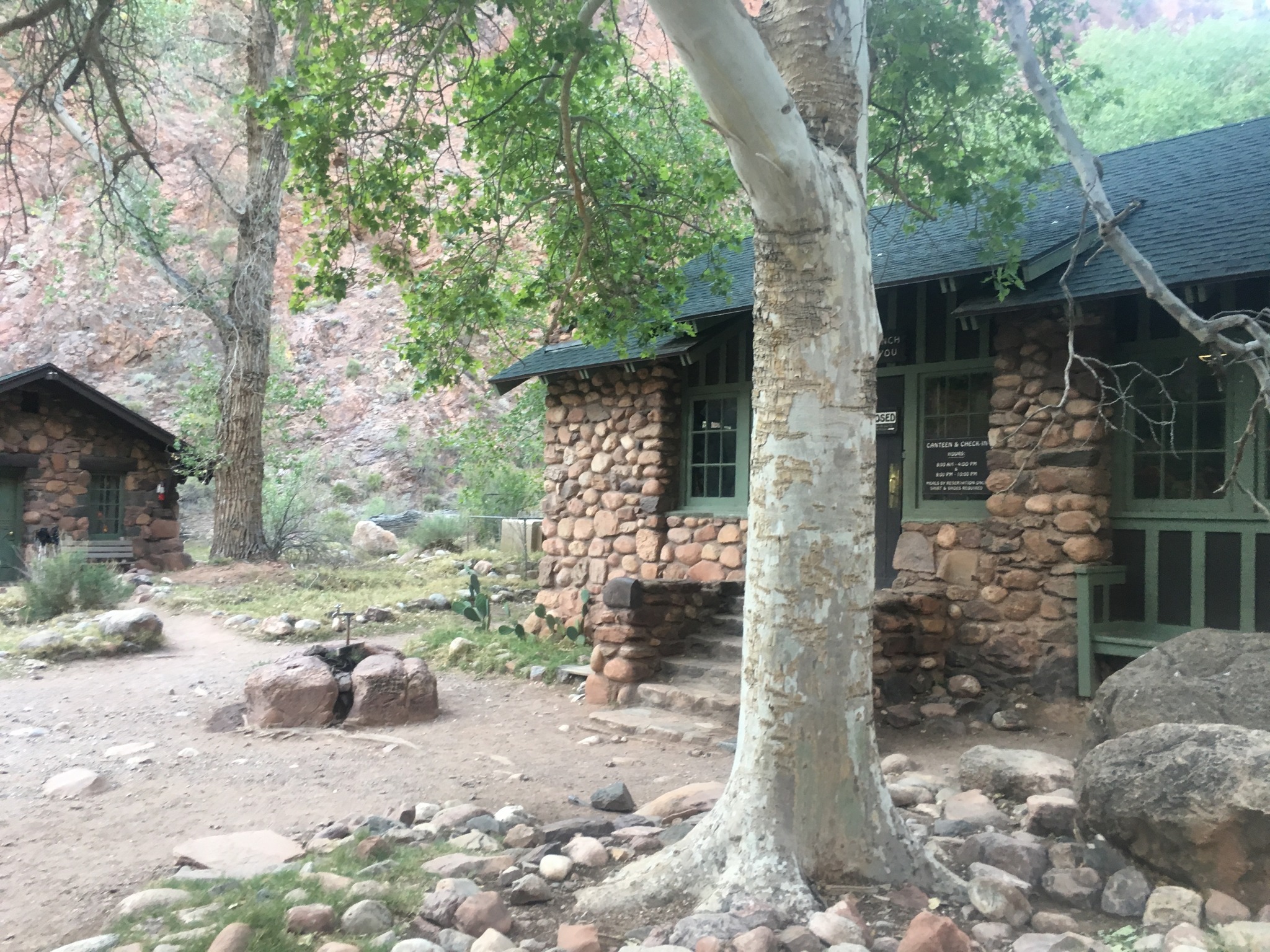
First stop… WATER! At this time, only Jamie and I had made it to Phantom Ranch, but Dewey and Brian weren’t far behind us. Dewey had experienced some hot spots on the way down from Cottonwood Campground, so he stopped to tend to his feet and wait for Brian. Jamie and I filled our bottles, took a few minutes to drink and refill, then set out to find the kitchen window with our food. We located the window, grabbed our sack lunch (you can reserve a sack lunch online for $14 at http://www.grandcanyonlodges.com/lodging/phantom-ranch/), and found an empty picnic table. Just as we sat down, we were attacked my gnats. Luckily, they didn’t seem to be biting, just annoying the hell out of us. The only way to avoid them is to keep moving, or continually wave your hat around your head. I was glad to sit down, but couldn’t wait to get moving again. I kept an eye on the trail hoping Dewey and Brian would come around the corner. 5 minutes went by, nothing. 10 minutes, nothing. “Where the heck are these guys?” That’s when I start to worry. Did they overheat? Did Sasquatch eat them? As it turns out, they found a different route into the camp, and were sitting at a table on the other side of the kitchen.
We hadn’t notified anyone of our status since we left at 4:42am. There is no cell service in Phantom Ranch, but I did locate a payphone. Unfortunately, the phone would not allow me to make a long distance collect call, and it has been about 10 years since I carried a calling card around. I know our families were worried sick, but other than smoke signals, there was nothing we could do.
Back to the sack lunch. All the way down North Kaibab trail, I dreamed about eating some real food. However, once I sat down, opened up my lunch, I realized my stomach was in no condition to eat much of anything. The lunch consisted of a bagel, cream cheese, jam, peanuts, and apple, Oreos, summer sausage, and electrolyte mix. I have never been one to turn down Oreos, so those were the first to be consumed…. they were delicious! I ate about half the bag of salted peanuts, and realized I couldn’t eat anything else. Even at rest, my heart rate was well over 100, and I knew processing food wasn’t going to be easy once I started up the Bright Angel Trail. Dewey was experiencing some stomach issues, but I think he felt better once he “called the dinosaurs.” Brian’s face showed pure exhaustion, and the intense heat wasn’t helping. Jamie and I packed up our stuff, filled our bottles, and told them we would see them at the top. As we were leaving the camp, we ran into a hiker we had seen earlier. He told us how awesome we were doing, and filled us in on some info I could have gone without hearing…. it had reached 97 degrees at Phantom Ranch.
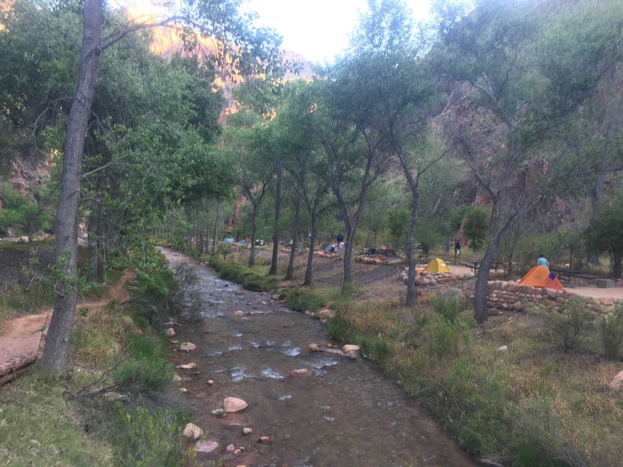
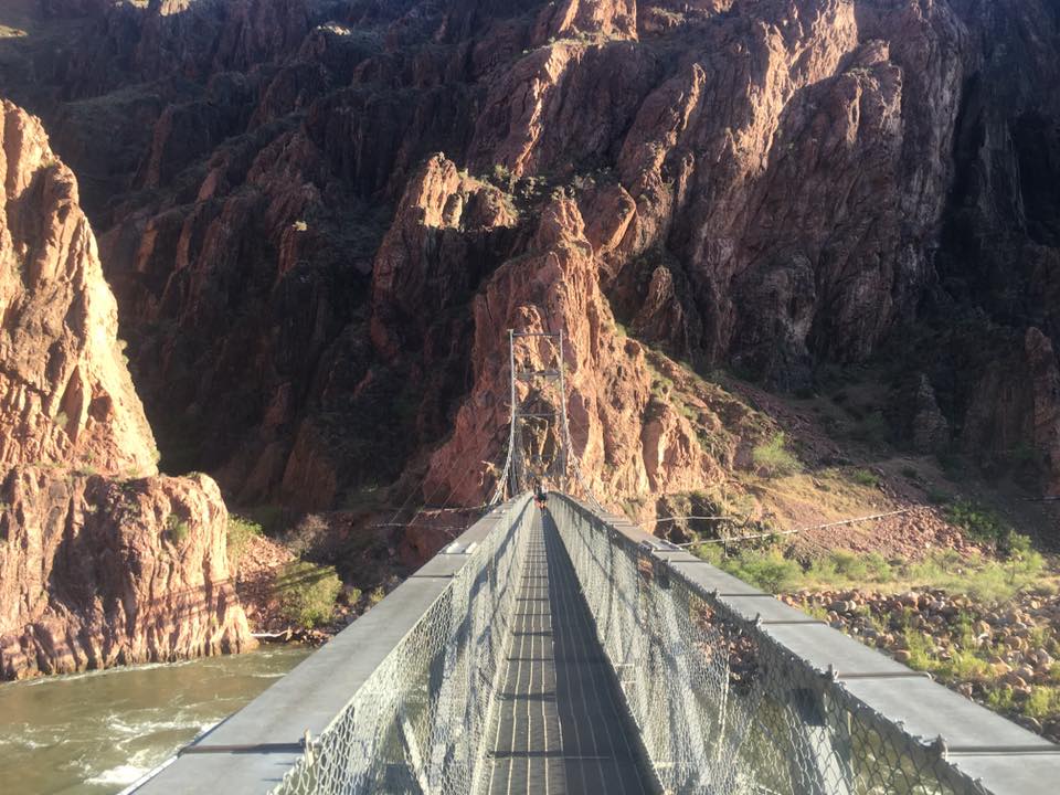
We trekked through Bright Angel Campground (collocated with Phantom Ranch) and came to the long, silver bridge that crosses the Colorado River (2,480 feet, 6 pm). Another small victory, this was the gateway to the last leg of our journey. We had accepted the fact that we weren’t going to complete the 9.5 mile climb before dark, so there was no point in pushing too hard. However, I really wanted to just finish, lay down, and take a nap, so that kept me moving forward. Jamie and I spread out a little, and would leap frog from time to time. She was having hip flexor pain, and stepping up with her right leg was getting increasingly difficult (she ended up completing the climb only stepping up with her left leg… ouch!). As for me, I didn’t have any isolated pain, but my whole body was hurting. I popped an ibuprofen just before we left Phantom Ranch, and that seemed to help dull the pain a little.
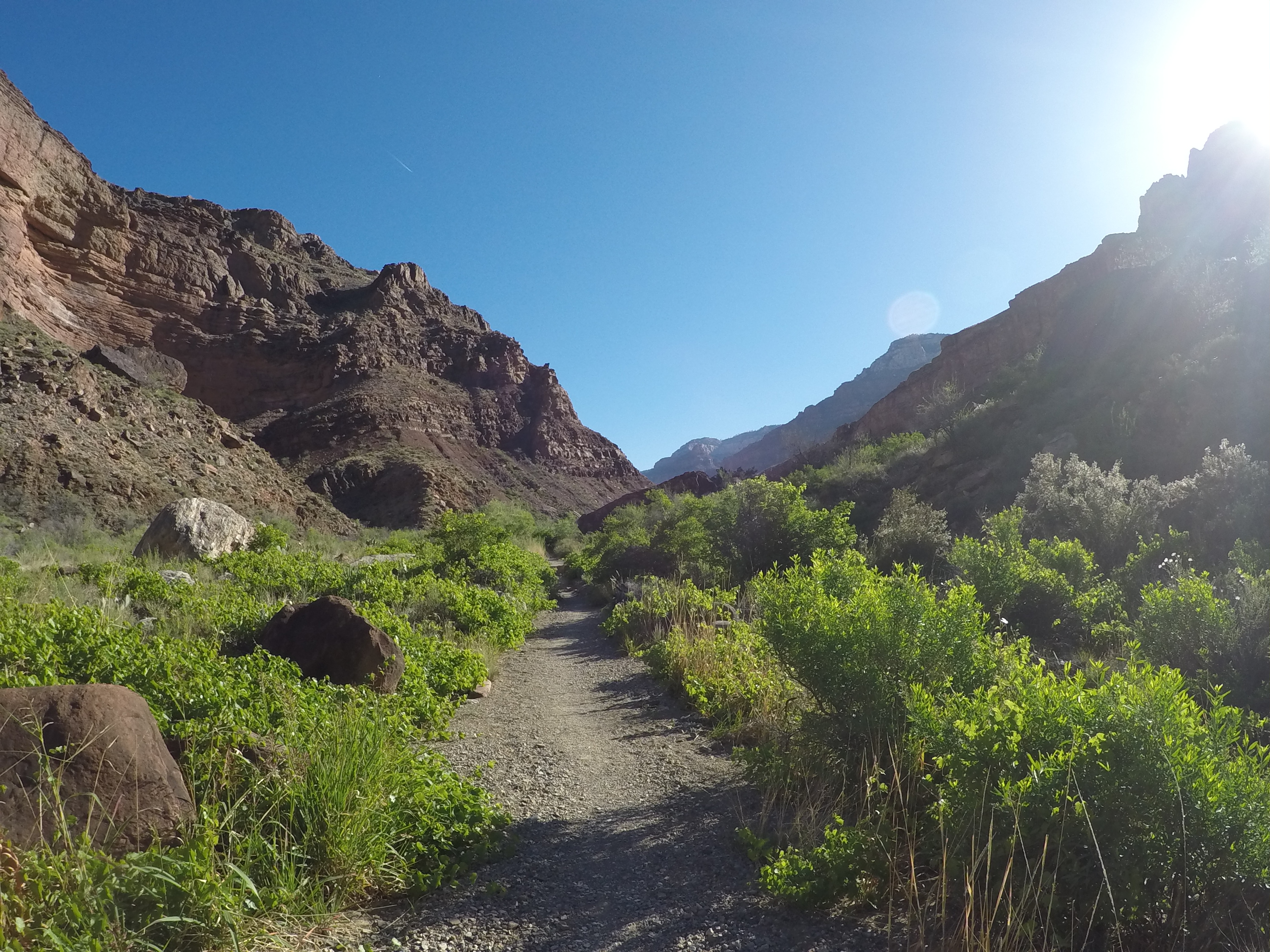
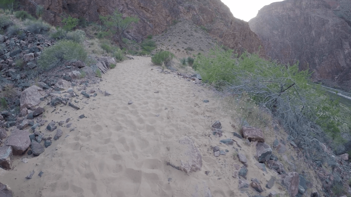
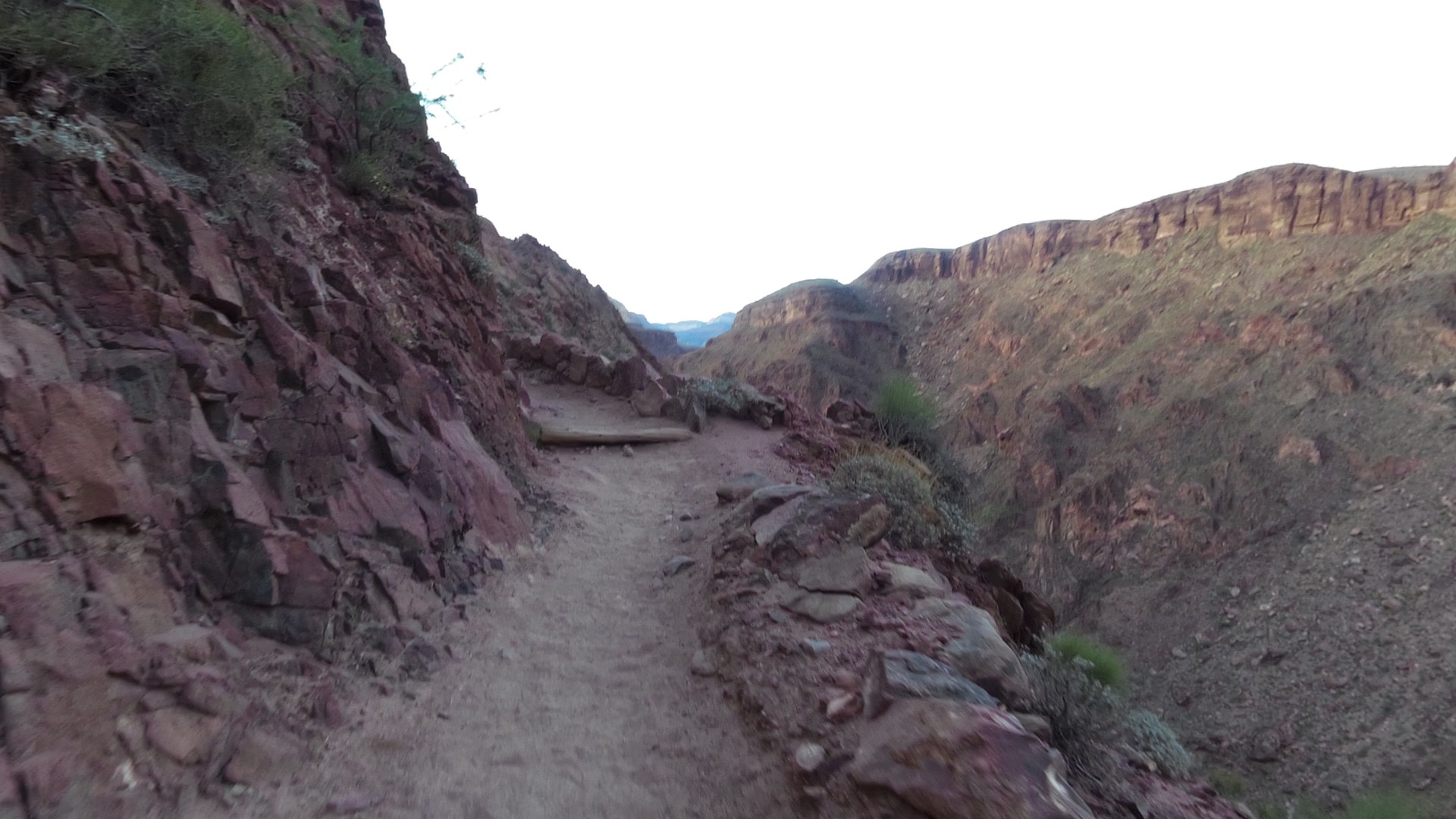
I had read a couple dozen blogs about the R2R2R adventure, and I don’t remember anyone talking about the deep sand on Bright Angel Trail. Where the heck did this stuff come from?! It was like walking on the beach, if the beach was on the side of a mountain. This was another time I was so thankful to have gaiters on. The deep sand felt like you were taking two steps forward and one step back; you just couldn’t seem to get a lot of momentum from each step. Nevertheless, we continued on, and put the half-mile of sand behind us.
The sun was setting and painting the rocks with some amazing colors and shadows, but at this point, I really didn’t care. I stopped a few times to get photos and video, but I found it difficult to get moving again. Throughout the rest of the evening, my photo ops became few and far between. The climb continued past the River Resthouse, which I quickly realized had no drinking water source. I had made the decision to save weight and only fill two 20oz bottles at Phantom Ranch, which was obviously not enough to get me to Indian Gardens… hind sight is always 20/20. I looked back to check on my teammate, but she wasn’t in sight. I made the decision to press on for Indian Gardens, get some water, and wait for her there.
As I continued, I came across a couple hikers going rim-to-river-to-rim. We chatted about how warm it was, and how I was running very low on water (as in I had none left). The next water stop wasn’t far, but they offered up some of their water anyway. I graciously took about 10oz from them and we hiked together for about 10 minutes or so. We traversed the creek crossings and enjoyed cool breeze blowing through the tall trees growing near the stream. Just as dark was starting to hit, we made it to Indian Gardens (3,800 feet, 8pm). I dropped my pack, filled my bottles, and rested for a few minutes. Jamie appeared from around the corner with some great news. “Did you get cell service?” I hadn’t even tried since we left the North Rim, so I pulled out my phone and sure enough, cell service! I sent a message to the group we set up for all of the wives to let them know we were alive, but way behind schedule. I felt an instant weight off my shoulders. Time to move on.
The scenery changed from breathtaking landscapes to a brightly lit 10-foot circle directly in front of me. I could, however, see the headlamps in the distance as hikers made their way to the top; I still had a very long way to go. Just as I knew it would, my watch finally started to let me know it wasn’t going to last the entire trip. The reduced battery life could probably be attributed to how hard it has to work finding and keeping satellite connections while in the canyon. Moments before our next water stop, it finally died (4,500 feet, 8:30pm).
A dozen or so painful switchbacks later, we hit the 3 Mile Resthouse (4,748 feet, unknown time). The good news; we had three miles left. The bad news; we had three miles left. Jamie and I were sticking fairly close together and chatted a couple times as we climbed, but it was mostly quiet. I would crank up the volume on my iPod from time to time to get a little boost of energy, but I was running on reserves, and my reserves were almost empty. No matter how much food I took it, it just seemed to sit at the top of my stomach and made me more uncomfortable than anything. My heart rate was still crazy, so I would stop for a minute or two, sit on a rock, and try to catch my breath. It felt like I was breathing through a straw, and the straw was getting smaller with every passing mile. I turned off my headlight a few times as I sat and wondered how I got myself into this mess. What went wrong? Was it the heat? Was it the altitude? Did I underestimate the canyon?
We came across the 1.5 Mile Rest House (5,729 feet, unknown time), and I was too tired to celebrate. The last mile and a half was brutal, and I knew the next mile and a half would be the same. I filled my bottle and continued. This brings us to where my story first began. Exhausted, dehydrated, cranky, and in pain, I concentrated on putting one foot in front of the other. As soon as I made it to the second tunnel, I knew I was almost there. The lights from the buildings at the Bright Angel Trailhead were so close I could touch them. I heard voices above me… it was Lori (the gazelle) and JD (the driver), and they were cheering us on as we made our very last turn towards the top. I probably should have taken out my camera, or said something to mark the completion of this epic journey, but I wasn’t thinking straight. I do remember using a few choice words that are frowned upon in most public areas, but I was speaking from the heart. I was done. (6,860 feet, 10:30pm)

Although the car was only 50 yards away, I opted to rest before I went any further. I laid down on some rocks, turned off my lamp, and just stared at the stars for about 10 minutes while my heart rate finally dropped to somewhere below 100 bpm. I hobbled to the car like a penguin that had just been mauled by a polar bear, and grabbed a piece of cold pizza… it was delicious, but my body still wasn’t ready for food. I changed clothes and hopped in the van for a quick catnap while we waited for Brian and Dewey to emerge from the canyon (I was driving home, so I needed all the rest I could get). As they neared the rim, we hobbled back to the trailhead to cheer them on. Like me, they emerged from the canyon completely exhausted. The canyon didn’t kill us, but it sure did beat the living crap out of us. I think it was that point we all vowed to never do it again.
It has been just over a week since our R2R2R run. My legs are finally back to normal, but I’m taking a much needed break from running before I start training for fall marathons and ultras next week. The million-dollar question… will I run R2R2R again? As much as I would love to go back and actually reach my original goal of 15 hours or less, the jury is still out.
Great write up, thanks for the info. I’m looking forward to this run.